
The weather looked great – bluebird skies, warmer temps, and little wind – and we chose the day before to meet Doug at the Pine Bend Brook Trailhead to hike the Tripyramids. I checked the trail conditions reports right before we got on the road and saw that there was a report from yesterday by a woman who lost a dog named Sasha on Pine Bend Brook trail. When we got to the trailhead there were signs on her car and on the trailhead sign too. I had hoped we could help, especially since Rye tended to be pretty great at tracking smells on the trail, usually to our annoyance, but today her skills turned out to be useful.
We shed down to our first layers right away and headed up beautiful Pine Bend Brook trail which, unsurprisingly, follows Pine Bend Brook through the forest, rising steadily but mildly up. There was still a ton of snow, but the trail was pretty packed down. Not wanting to carry them anymore, I decided to throw on my snowshoes, but the guys were fine in their microspikes. This did mean many-a cringe-worthy stream crossing on them, but I figured it was just for the lower section. Little did I know I would be crossing back and forth over all the streams an extra 2 times.
At 1.7 miles the trail starts to climb a little more rapidly, and then you really hit the steeps at 2.3 miles as the trail climbs through a valley. We referred to this part as the solar oven, since the sun shone strongly on the bright snow, and the valley shielded us from wind so conditions went from fairly solid snow pack to steep mashed potato slush throughout the day.
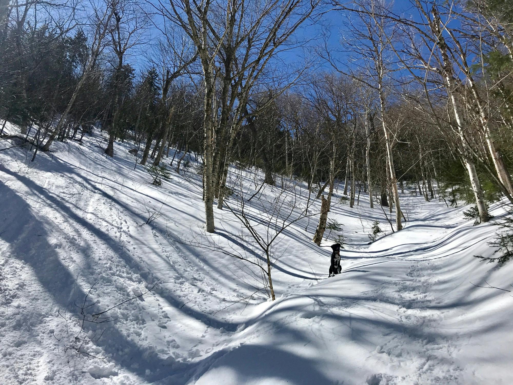
Rye perched on the sunny steeps
We missed our left turn and continued straight into the Pine forest after Rye, trying to find another way than the super slip-and-slide climb we mistook for back-country ski markings. We heard a whimper near the edge of the trees and thought, “we’re going to rescue this dog!”
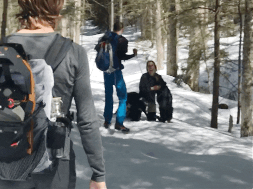
Rye of course knew she was up there and lead us right to her. Sasha was shaking in the pines on an incredibly steep slope. It was quite difficult to get our footing. As we moved closer to her, she would climb farther into the trees and bark at us. We tried to offer her dog treats, but she didn’t seem interested. This wasn’t going to be as easy as we thought. Doug ditched his pack and went around the other side with the bag of treats as we tried to herd her down the slope. Eventually, Doug cornered her into a shrubby Pine and as she positioned herself into a crawl to get through it, Doug employed the bear hug technique to tackle her down and get her on a leash. From my vantage point, it just looked like a pile of Doug, dog, and pine needles.
Luckily, her bark was worse than her bite, and she was just extremely scared. We lead her down the dangerously steep section to the real trail, and once we were on it, she was content to hike on the leash, leading the way. Many groups we passed were happy to see that we had found Sasha! Everybody loves a good found dog story. We figured our plans for summiting were over as we made our way back down the steep section, then through the forest, then awkwardly over the streams in snowshoes, and finally to her owner, Diane, who was so thankful we had found her 13 year old pup.
Sasha reunited with her happy owner
After telling our story to her and a local who came out for the rescue mission, we re-grouped about our plan. I was hungry at this point, probably still calorie deficient from my long run yesterday, and it had been a strenuous and exciting hike already. But we all knew that if we headed back into Lincoln and had lunch and some beers, it would make getting out there and hiking a smaller peak like Tecumseh that much harder. So, we made the group decision to turn right around and head back up.
By now the snow was much softer (slipperier). Even though we knew where not to go (into the Pines), we still had a hard time finding the trail up to the ridge, despite ample gps technology and having tracks in snow around. We just cut left at a certain point and followed nobodies’ tracks on a sketchy traverse to where we knew the trail would be. Happily, we saw a group of guys we had passed on our first trip down returning down a sure trail. From there, we were able to easily follow the trail to the summit.
Easy to follow, not easy to hike. We had figured we were past the hardest part of the trail and were almost there. Wrong. Though Cody, Doug and Rye had hiked this trail before, nobody could remember the steep winding trail that seems to never end up to the top of North Tripyramid. It was beautiful with the trees dripping in icicles, but we grew silent as each corner we found ourselves facing yet another steep push, getting iced on constantly and feeling shaky from exhaustion and hunger.
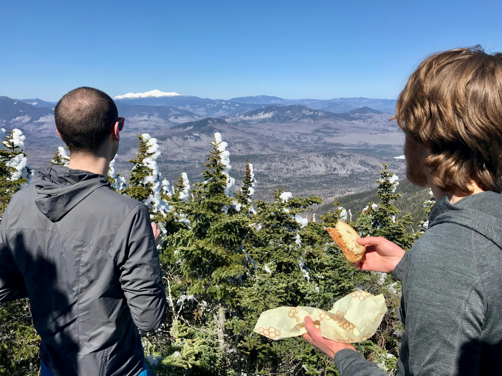
Mt Washington on a bluebird day
When we finally did make it to the top, we were rewarded with amazing views of Mount Washington from an overlook to the left of the summit. We ate some snacks, drank some water, and headed down the ridge to tag Middle and South Tripyramid and then, to beer and burgers!
Looking at the GPS on my watch, I was surprised that we had already made it to Middle Tripyramid at the junction with Sabbaday Brook Trail because it had a little mountain symbol there. But hooray, we shrugged off what seemed like a non-summit summit and continued on to what we thought was South Tripyramid but was really the actual Middle. The “peak” I saw was “Mount Tripyramid” which I’m still not sure is a real thing. Oh well, we at least made it up to the two official 4,000 footers.
We quickly made our way down icicle tree steeps, past the junction with Scaur Trail. We got a little turned around here, but made it back down the ridge and to the sketchy traverse once again. This time, we followed the more well-trod section and found out it actually was no better, if not worse, than the way we came up. We precariously made our way down without too much sliding by hunkering down on our snowshoes (the guys had changed into theirs by this point) and our poles and making our way tree to tree, feeling the risk of somersaulting down at any moment. It was that steep.
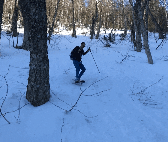
Doug heading down the steeps
I had to do a butt-slide down the last steep section of the trail (sorry, not sorry folks! It was a fun ride and certainly entertained Rye). Then over the streams yet again on the snowshoes, then what seemed like an endless final stretch of forest before we finally made it back to the Kanc. Sasha’s owner had replaced the “Lost” with “Found” on her sign with a thanks to everyone who helped in the search. We were so proud of Rye for her abilities to track her down. We headed off to the Woodstock Inn and Brewery for burgers, beers, and bloomin’ onions, recounting a much more epic day than the four of us had expected.
Peaks
North Tripyramid (4,180'), Middle Tripyramid (4,140')
Trailhead
Pine Bend Brook (Kancamagus Hwy)
Trails
Pine Bend Brook Trail, Tripyramid Trail
Distance
15.42 miles, 5,324' elevation gain
Time
Start: 9:11am, 8:23 Round Trip
Weather
Warm and sunny!
Trail Conditions
Still tons of snow, but all packed down before the sun hit, then it was a mashed-potato slushy party.
Gear
Snowshoes
Partners in Crime
Cody, Doug, Rye, with a guest appearance of Sasha, the found dog.
Gallery

Rye perched on the sunny steeps

Cody looking up the steeps

We got Sasha!

Crew heading back to the start

Sasha almost back to her owner

Sasha reunited with a happy owner

Re-fueling before the steeps on round two

Still so much snow on the ridge

Mt Washington on a bluebird day

Mt Washington from North Tripyramid

The other direction (from Middle Tripyramid)

Sun through the icicle forest

Cody, Doug and Rye. Tired but excited to get down to beers

Me and Doug

Doug coming down the steepest bit

The last bit through the forest

Dog found!


