
This is one of my favorite hikes in the Whites. The views of the Presidentials are amazing, it’s a challenging hike elevation-wise, and there doesn’t tend to be a lot of people up here, even during peak season, and my favorite AMC Hut is along the route, complete with a perfect lake for a dip. Usually, it makes sense to start the hike up Nineteen Mile Brook Trail and come down Imp because of the steep section up to Carter Dome from the Hut, and you get most of your climbing done en route. The downside is you end with a mile walk along the side of the highway back to your car. We decided to try the loop in reverse this time, with grand ambitions of hitting the Wildcats if we felt like it afterwards from the hut. I liked this direction because we used our mile along the road as a warmup, and got a nice coffee cake reward from the hut on the way back down.
Hiking up Imp Trail is moderately challenging. It’s basically just a long steady climb through the forest with many stair-steppy boulders for three miles. Then you get to N Carter Trail and the climb continues for a few more miles through thinner and thinner trees until you reach the junction with Carter-Moriah trail just below the summit of Middle Carter at 6 miles (5 if you don’t count the road). The views from the summit aren’t great, but there are a few shoots off the trail along the way with really nice ones of the Presidentials to the West and the Baldfaces and Maine to the East.
It’s a rolling descent and then slight rise on the forested ridge to the anti-climatic South Carter summit (7.2 miles), and a further descent to an important junction with the Carter Dome trail in two spots. Definitely don’t take this trail. Instead, make the left to continue onto Carter-Moriah straight (vertically) up to spectacular Mount Hight, the best part of the whole traverse, despite not being an official 4000 footer. Coming from this direction, this decision is much more punishing compared with the relatively flat cut over from Carter Dome, but you’d have to gain those feet anyways to get up there.
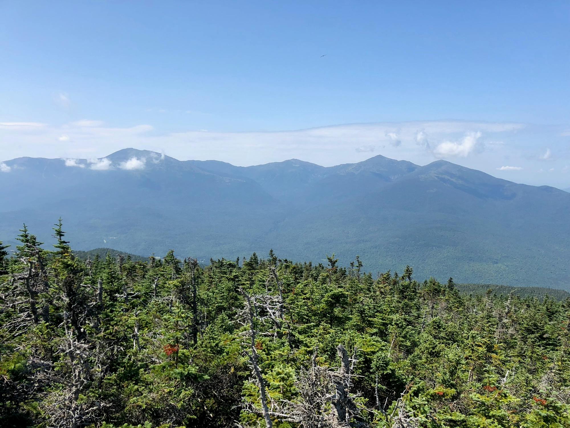
View of the Presidentials from Mount Hight
Mount High is a great spot to hang out and take in the panoramic views from its rocky summit. We saw many an AT thru hiker hanging around up there (and also along the trail, almost to Maine by now). I wished we had brought along books for a proper break, as our legs (and Cody’s stomach) were telling us Wildcats probably weren’t in the cards today anyways. We reluctantly bid adieu to this magical place and headed for our last summit of the day, Carter Dome.
Since the other two times I did this traverse had the trail covered with snow, I was expecting more for a view from Carter Dome, so was a little disappointed to find the views obstructed by scrubby pines. Oh well. We descended slowly down the trail toward the hut at first, and then the dreaded steep section that wasn’t actually bad at all (especially after our experience coming down Holt trail on Cardigan last weekend – no post, but just check out this image). It was just like some narrow stairs for a pretty short stretch, and then we were standing on the banks of the lillypad filled pond, the smell of hut baked goods wafting through the air. Oh, make sure to check out the lookout right before the steep descent. It’s a great spot to sit and survey the Wildcats and the hut below.
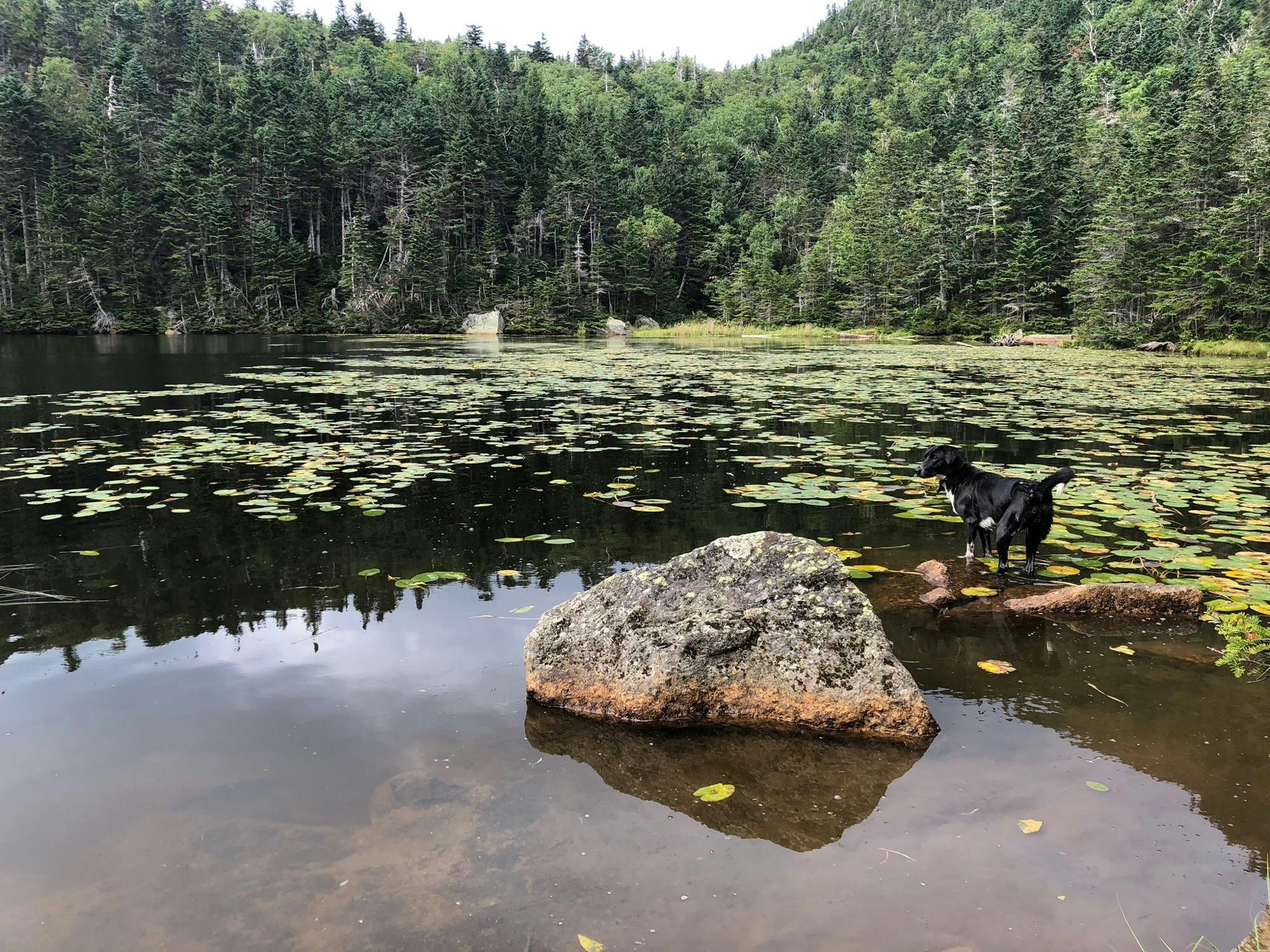
Rye in the Lillypads
I wish we could have stayed the night at the hut. It looked like a fun crew of AT Hikers and families, and they were playing Punch Brothers while baking delicious bread, but alas, our dog owning and job having lifestyle turned us down Nineteen Mile Brook and for the long bouldery descent back to our car.
Peaks
Middle Carter (4610'), South Carter (4430'), Carter Dome (4832'), Mount Hight (4675')
Trailhead
Nineteen Mile Brook
Trails
Imp Trail, N Carter Trail, Carter-Moriah Trail, Nineteen Mile Brook
Distance
15.5 miles, 4,833' elevation gain
Time
Start: 9:30am, 7:44 Round Trip
Weather
Cool and partly cloudy with hazy views of the Presidentials
Trail Conditions
Nice dry summer trail
Partners in Crime
Cody + Rye
Gallery

View of the Presidentials

Me and Rye atop Mount Hight

Cody and Rye atop Mount Hight

Rye in the Lillypads


