
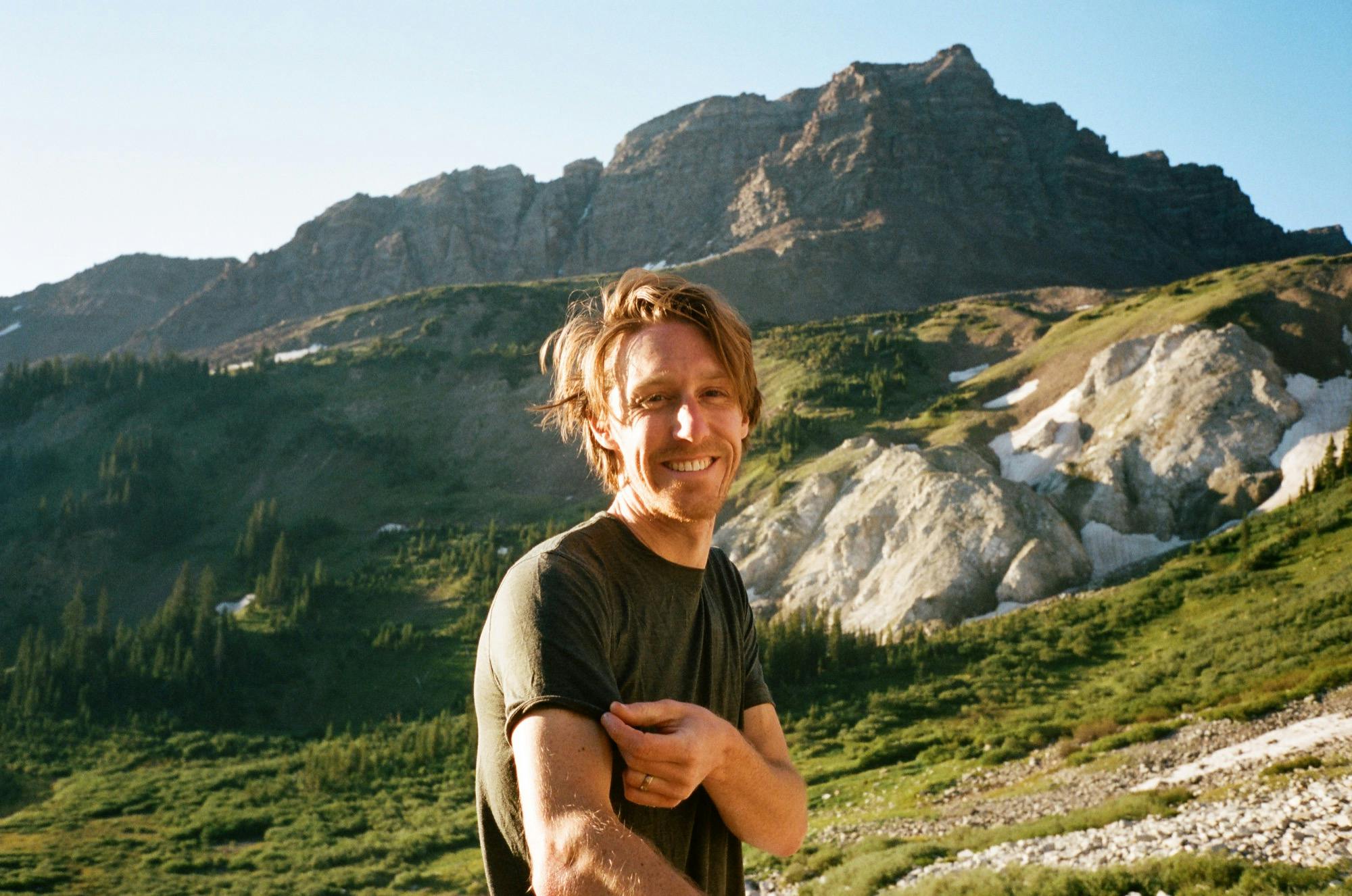
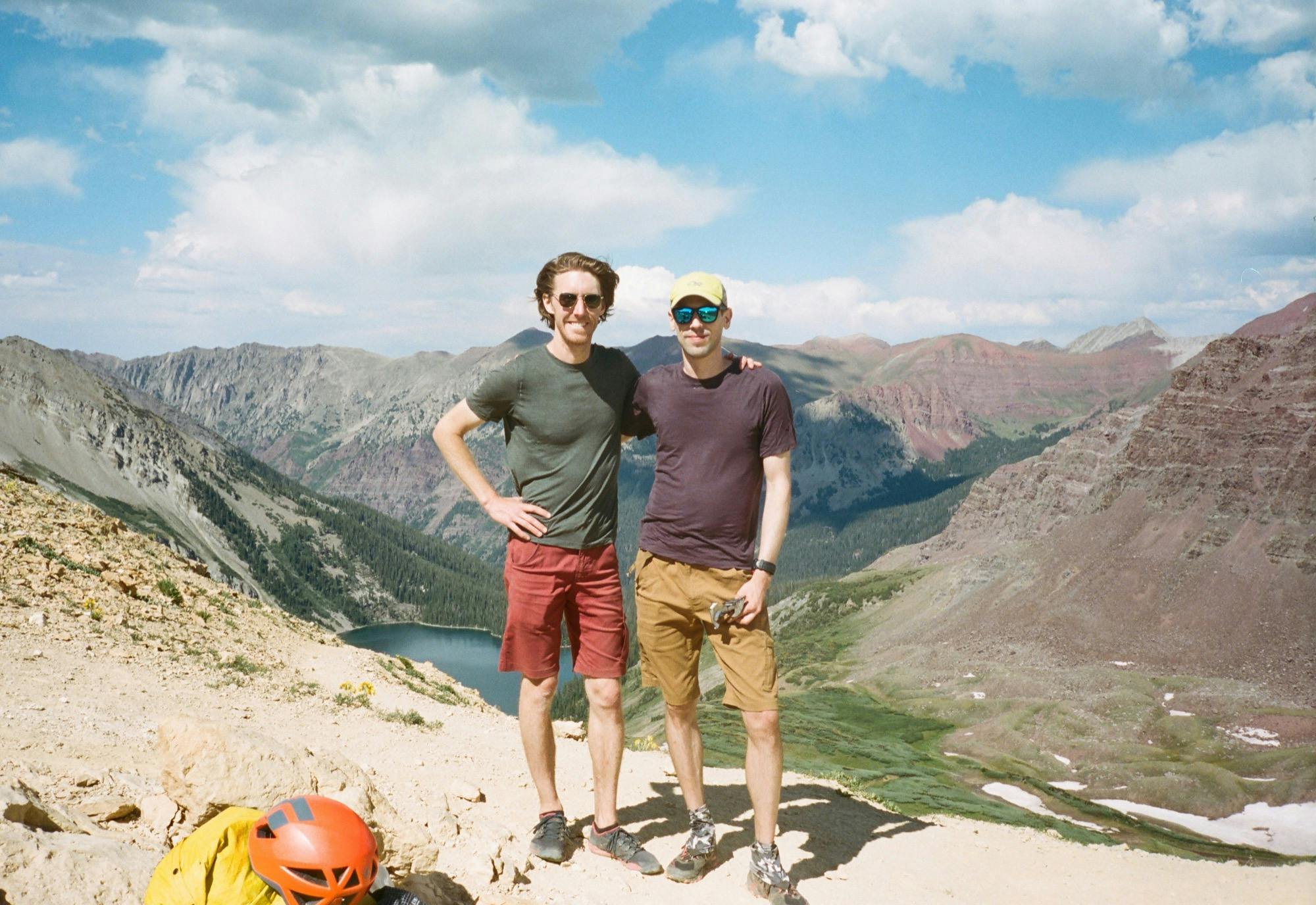
My first visit to Colorado was epic. In the words of mountain man Rob (more on him later), I'm a “spoiled brat”, and I agree. I found myself in the midst of the “last bastion of Colorado wilderness” doing what's known as the Capitol Creek Circuit. To be honest, I had no idea what this trip was going to be like, having left all the planning to Cody and Doug since Doug lived in Boulder during grad school, and Cody is an expert about all things “West”. This was illustrated by the fact that I was sure there were Grizzly Bears where we were going until the guys finally informed me this was not so just as we embarked on Day 1. Only black bears here, folks (and we actually spotted two of them)!
The following is my account of our five day, four night backpacking adventure, my first fourteener, how to deal (or not deal) with mosquito swarms, and how to spend a solid stretch of life unplugged and amazed by how freaking beautiful wilderness can be.
Where
White River Wilderness, Colorado
Distance
49 miles including Snowmass and Haystack Mountains, 40ish otherwise
Elevation Gain/Loss
13,600' with above peaks
Duration
5 days, 4 nights
Partners in Crime
Cody & Doug
Day 1
Maroon Snowmass Trailhead to Snowmass Lake
We started on the trail at the leisurely hour of 1:20pm, anticipating a pretty mild first day, and prioritizing a few last civilized meals and ice creams in towns on our drive. With deli sandwiches for our first night at camp stuffed into the tiny amount of room left in our packs, we said goodbye to the rental car and cell service and headed out south on the Maroon Snowmass Trail.
The first mile or so passes through private lands with a series of gates to test your gate-opening and closing skills. We got passed by one group on horseback heading back to the trailhead, and we tiptoed around piles of droppings for the first mile or so. Though the trail was basically a dusty red sidewalk, I felt the weight of my pack on fresh and delicate shoulders with every step. The familiar thoughts on the first day out backpacking came: “can I really carry this load 40 miles?”, and some less familiar thoughts, “will the packs I handmade for Cody and me make it? What happens if a strap falls off at mile 20?”. This wasn't the most ideal place to find out. I hoped my craftiness would hold up and made a mental note to bring an emergency needle and strong thread next time.
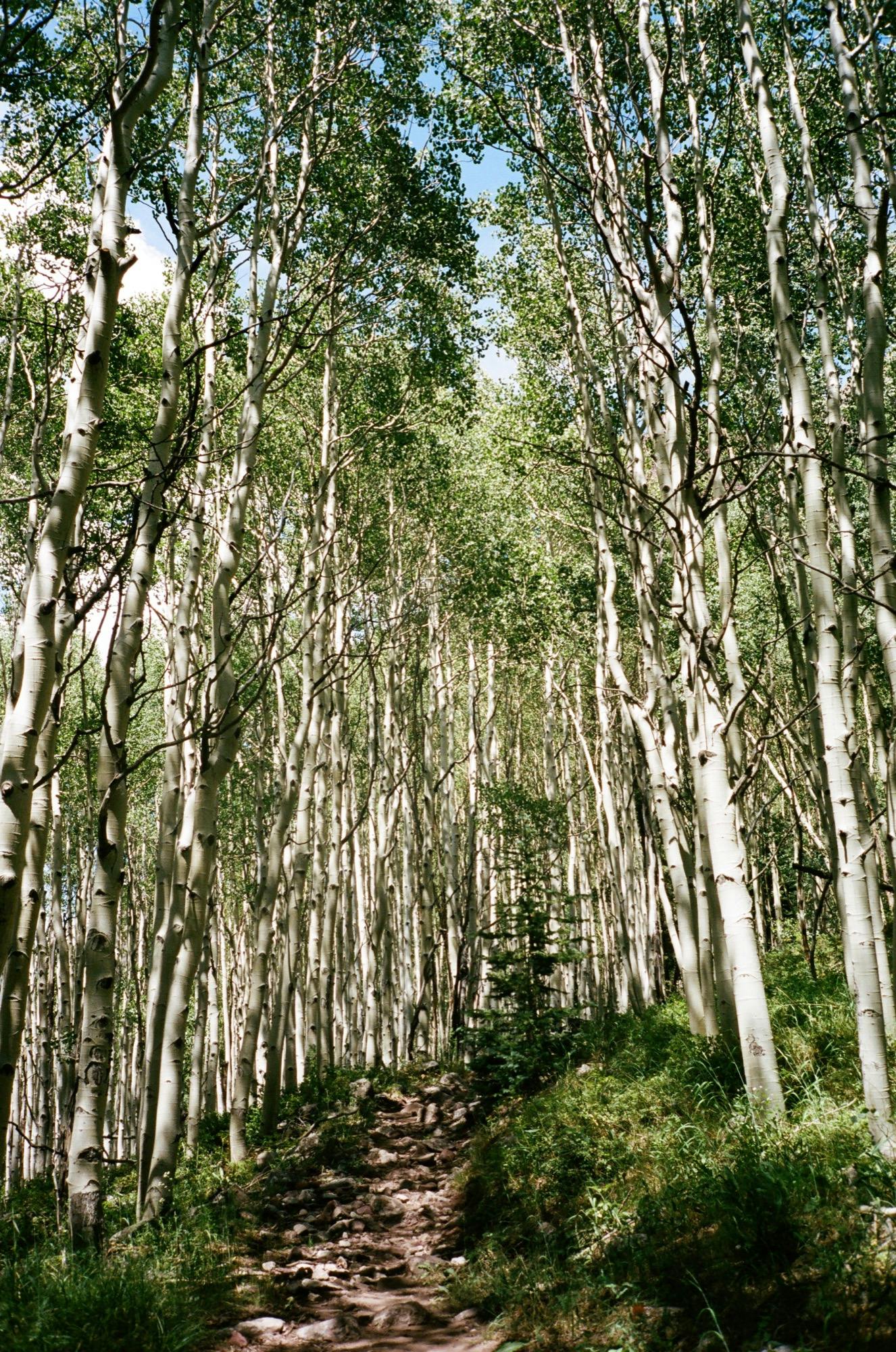
Aspen grove
We followed rushing Snowmass Creek, in and out of Aspen forests. Despite the weight and anxieties, the first three miles passed quickly. We stopped to take the first dip into our snack pile shortly thereafter, dropping pack and hanging out briefly on some logs over the river. Mile five brought a little more climbing and our first views of the snowy-ish (not a good snow year) rocky peaks that would fill our views over the coming days.
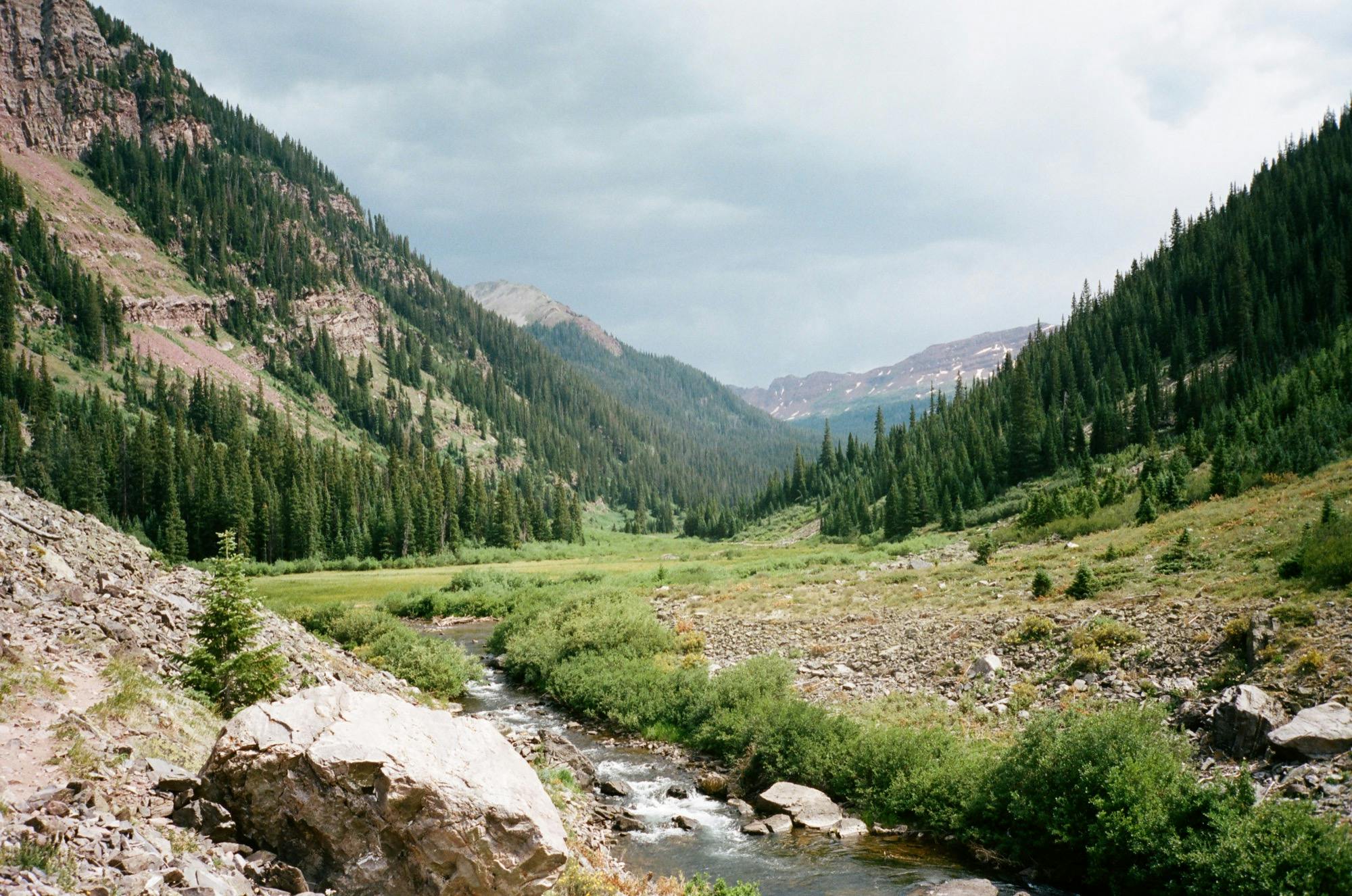
Snowmass Creek through the valley
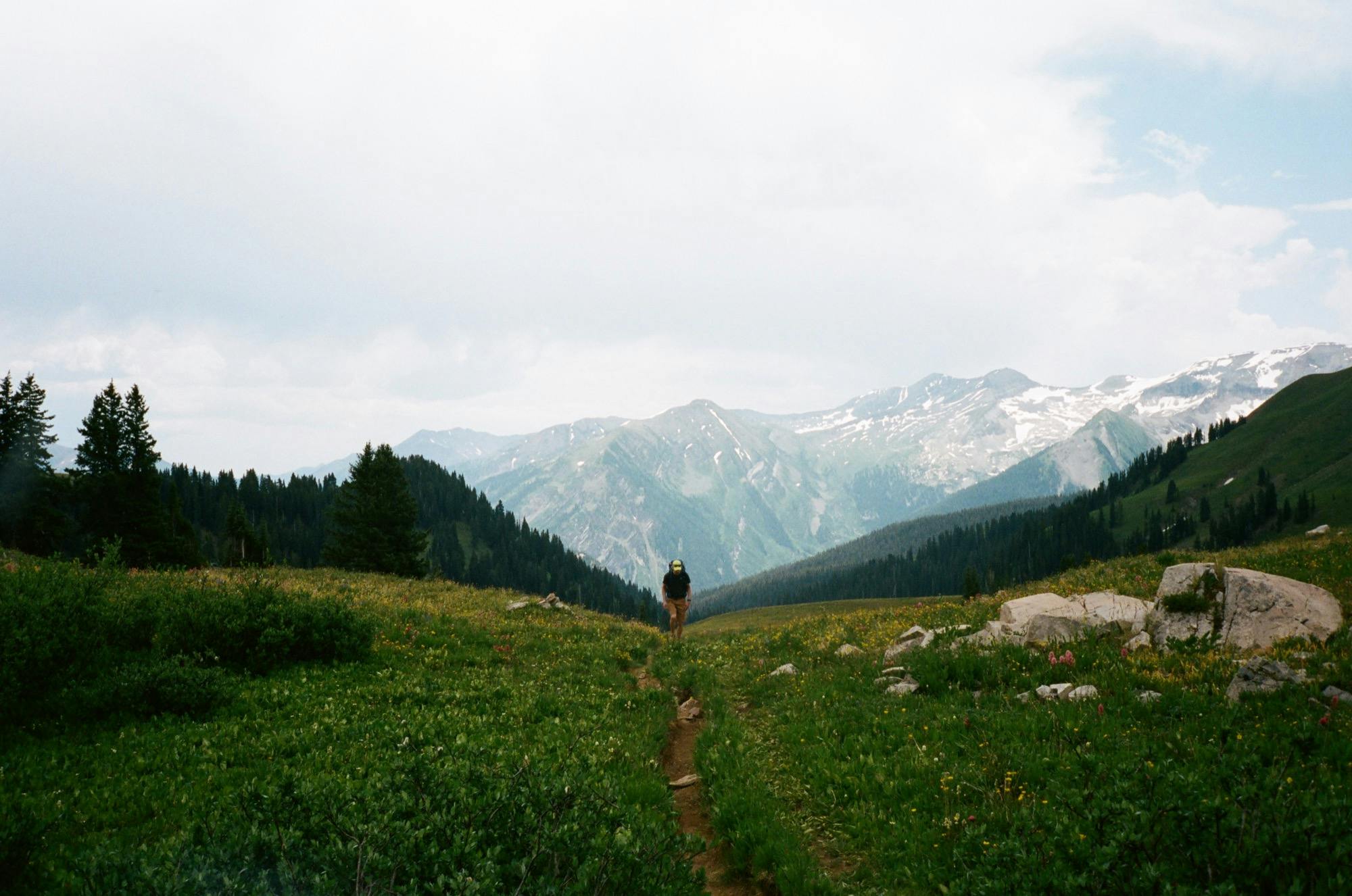
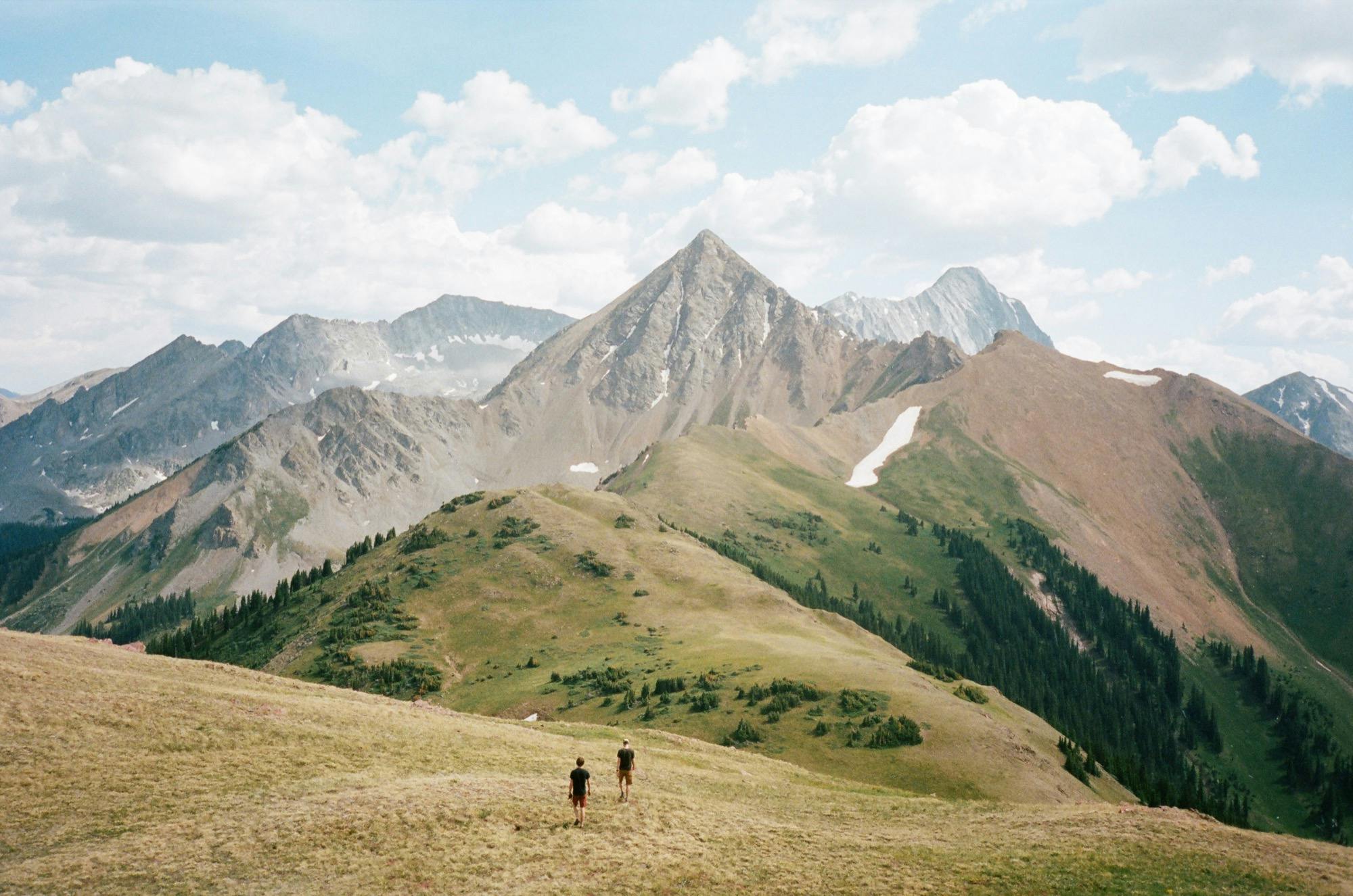
We emerged from the shady forest around mile seven into a lovely valley cut through by the creek, framing red (maroon?) mountains in the background. We approached a small marshy lake held up by a log jam, which we easily crossed. On the other side, we followed a couple of switchbacks, guarded by many adorable marmots, with nice views back down toward the lake before heading back into the woods for the last mile up to Snowmass Lake.
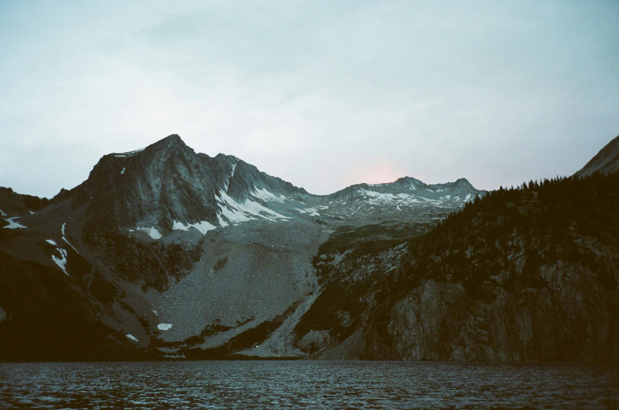
While the guys were taking pictures of the small trickling waterfall right before the lake, I went up ahead to see the majestic views of Snowmass Mountain, set behind steely waters of lake. As they came up behind me, we had a moment of awe and anticipation about our planned hike up to the summit the next day. And then we were attacked by a mean gang of mosquitos.
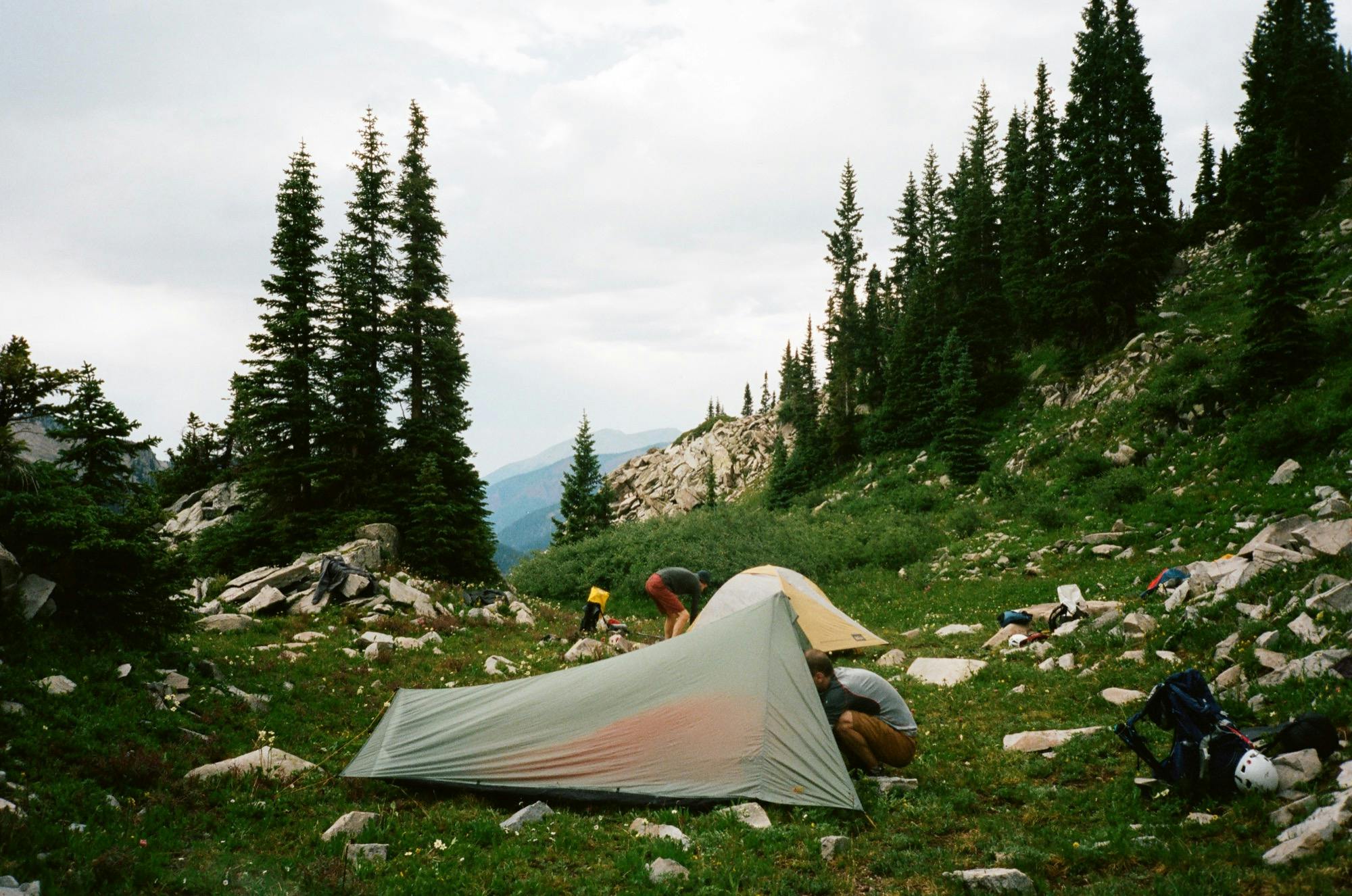
Arriving at Snowmass Lake
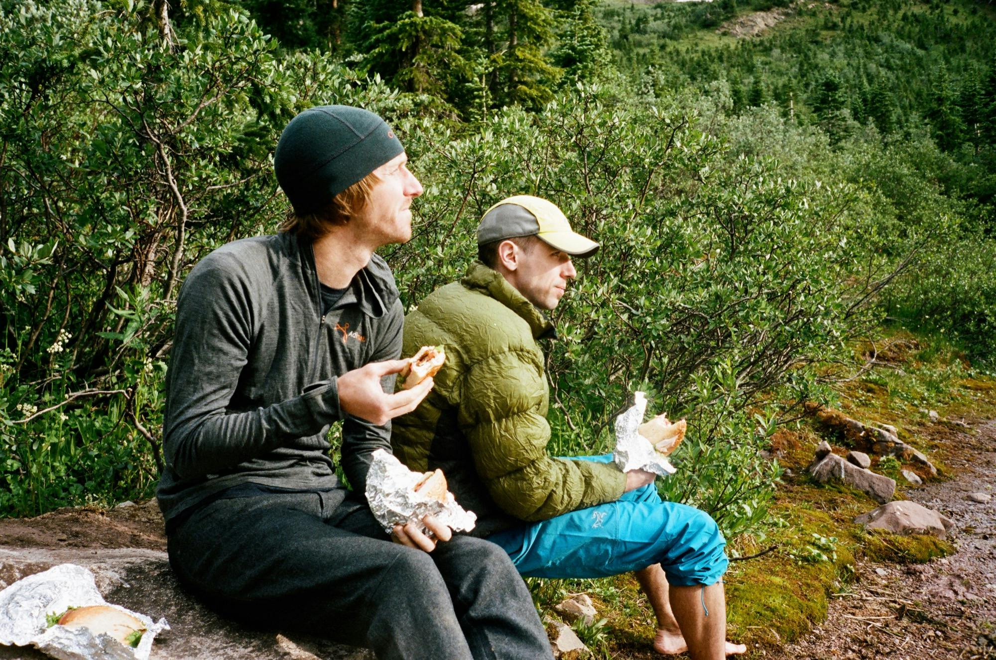
Moment ruined, we decided to quickly find a suitable campsite. Though there were many people camped up here — 'twas the eve of the 4th of July after all — we easily found a spot to throw up the tents (only after throwing on whatever mosquito-resistant clothing I could manage). I was excited to see a red fox come confidently through our campsite, then a group of deer. Camp secured, we took our civilization sandwiches back down to the shore where a little breeze made us a little bit harder targets. We took the willow trail around the lake a bit and found a tucked away spot where we could get a good view of the mountain, eat our sandwiches, and filter some water.
Well, there wasn't really as much of a snowy mass as we had expected there to be based on the research we (ahem, Cody and Doug) had done about the peak. One of the characteristic parts about hiking up Snowmass Mountain is a substantial section where you don your crampons and put one sharp foot in front of the other straight up to the ridgeline. Because of the little snow this winter brought, we wouldn't be doing that, and not knowing the quality (loose/stable) of the stuff that lay beneath the snow made me nervous. Also, from our angle, the section right by the waterfall in the first third of the hike, “the gulch”, looked very loose and steep.
Sizing up Snowmass with Sandwiches
As we were hemming and hawing about what to do, I asked a group filtering some water nearby if they had hiked to the summit. They said no, but they had talked to a group from Kansas at camp who had just gotten back. They had hired guides, started at 2am, took 12 hours round trip, and they needed to rope up and use crampons. But good luck to us! We had figured it'd take us half that time to get up and down the purportedly 4 mile round trip hike (spoiler: it's really closer to 6.5 miles). We chalked their tale up to flatlander inexperience, and decided to take a little hike around the lake to get a closer view.
When we weren't assaulted by willow branches, we were stepping into deep mud or tussocks of wet moss, soaking our only pair of shoes. At least we were able to figure out where the best route was for the early morning in our not-so-dry run. (There is a section where you ought to go uphill a ways to avoid the wet mossy section. It's marked by a flimsy piece of wood, but we ignored that the first time). We made it about half way to the boulder field where the climb up the mountain starts and we decided enough was enough with this trail and we would see what we could see from here. Things didn't look much better at the gulch. It looked steep and loose, but some other sections ended up looking better than we thought. We decided there was no way to know unless we started up, so we would make the attempt with the agreement that we would turn back if and when things felt too sketchy.
A cloudy sunset behind Snowmass
With that decision, we went back to camp and to tent early because staying out meant being eaten alive. We set our alarms for 5:30 and fell asleep with anticipation about the exciting adventure to come.
Date
July 3, 2018
Where
Maroon Snowmass Tralhead to Snomass Lake
Distance
9 miles, 2,948' Elevation Gain
Time
Start 1:20pm, 4hrs total
Wildlife Sightings
Red fox, many Moose Deer and Marmots
Highs
Red fox sighting, views of Snowmass
Lows
The Snowmass debate — to stay or to go, closely followed by the mosquito attack
Day 2, Part 1
Summitting Snowmass Mountain
Our earliest start of the trip, we awoke with anticipation for the uncertain hike ahead of us. The weather was beautiful, crisp, cool and clear, and the mosquitos made sure we didn't linger around camp. After a quick breakfast assembling our gear for the Snowmass Mountain out and back, we set out down the willow trail around the lake.
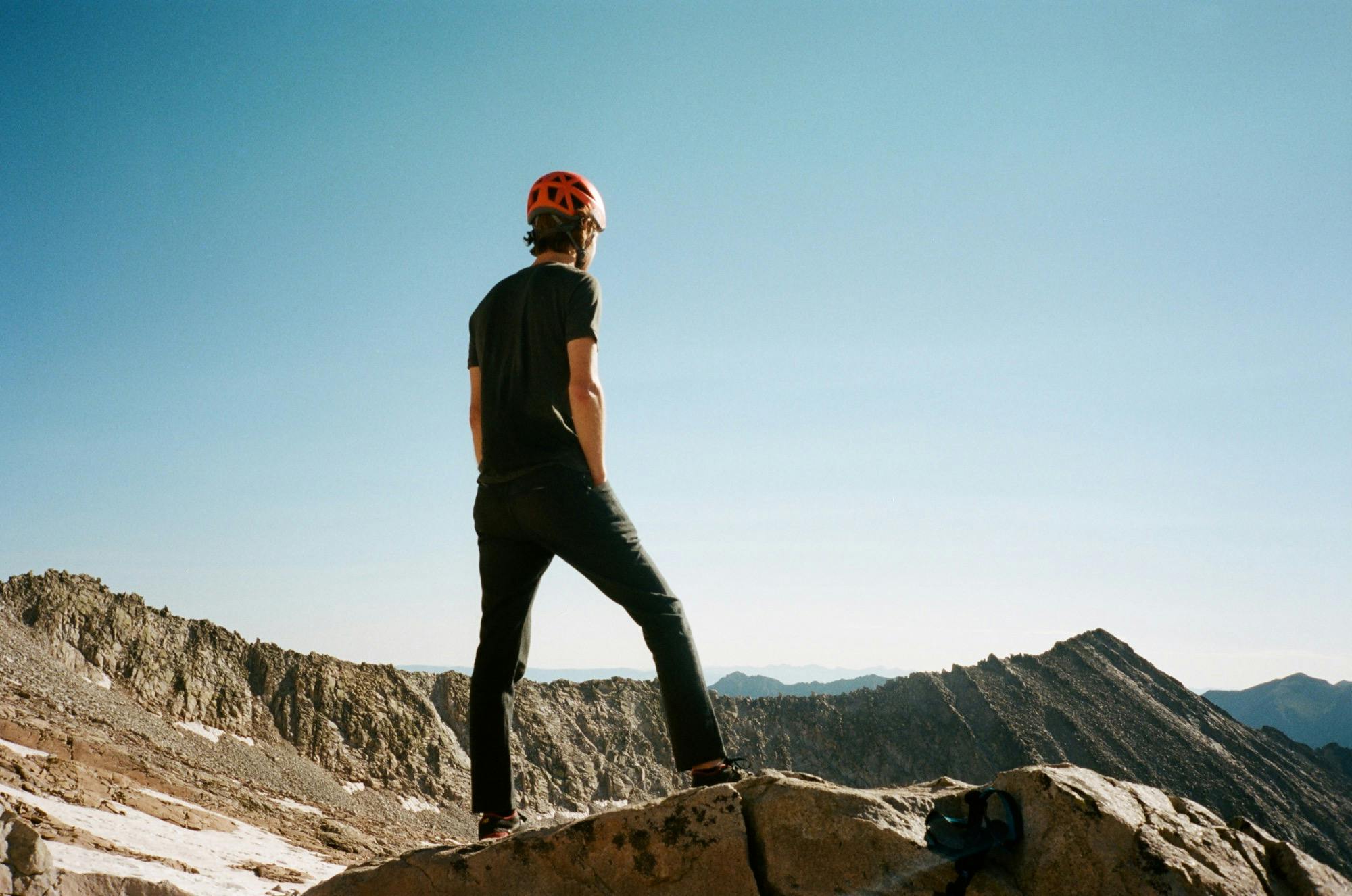
We made it around the lake to the large boulder field at the foot of the climb as the sun started to come up across the lake. From here, we felt way more confident about climbing the scree field, but still a bit unsure about what the gully would be like. We put on our helmets and started up, passing marmots keeping lookout on choice boulders.
Cody in the sun
As we climbed, the rocks got increasingly smaller. The first section is huge boulders, hopping from one very solid one to the next, and eventually that turns into some basketball-sized ones among pebbly sandy stuff. It also got steeper. But we were always able to pick out the more stable ones, and assessed the risk of falling as not very bad since you would only slide a few feet before stopping on a more stable rock.
Before I knew it, we had made it to the gully — to the top of the waterfall where the trail crosses to the other side and continues through a very nice verdant flattish green section. Crossing the waterfall felt like the sketchiest part, by far, of the hike. The actual footing on the around 15' stretch was quite easy, but looking back down to the lake, if you slipped on the wet rock, it'd be quite a long fall.
Standing on a large flat boulder
Once across, comes the nice easy green section with a clear dirt trough to follow. We took a snack break on a flat spot at around 12,000 feet, 1.5 miles in. It was a great spot to hang out in the sun, but alas we had a long way to go.
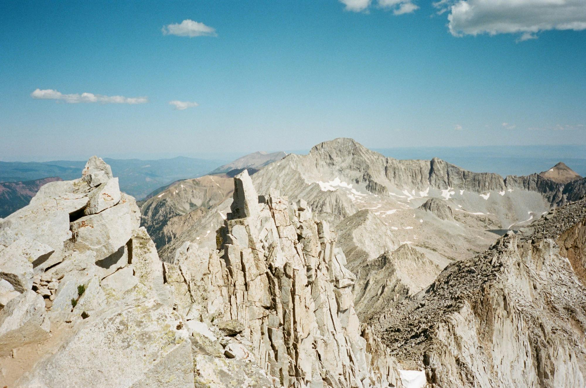
After the green comes a long section of huge boulders, which were very solid and easy to hike. We were able to find some cairns, but there was no very clear route, and there seemed to be multiple cairn routes to follow. We aimed toward the summit, and when we came closer to what was left of the snow mass, we aimed to the left of it, toward “The Bump” (the spot to aim for approaching from this direction, to the left of the summit about 1/3 mile).
Staring up the ridge
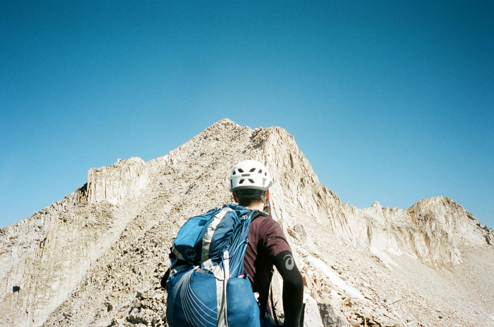
As we approached the ridge, the boulders became smaller and looser. We had to cross some pretty minor snow patches, but the crampons came for a free ride the whole way. I put my poles away as there were some sections that required some scrambling. We spent a bit of time spotting cairns here, but were able to follow one to another to get up to The Bump and over to the other side of the ridge.
It was so exciting to get to the ridge, climb over it, and get a completely new view of the other side. Breathtaking. I braced myself and made a careful cilmb down the clear trail on the other side, which descended a ways before starting the ascent up to the summit. There was definitely some scrambly loose sections, but we had made it so far, and I always found adequate hand holds. It took us a while to carefully cross this section.
Doug at the summit
Rocky ridgeline at Snowmass Mountain summit
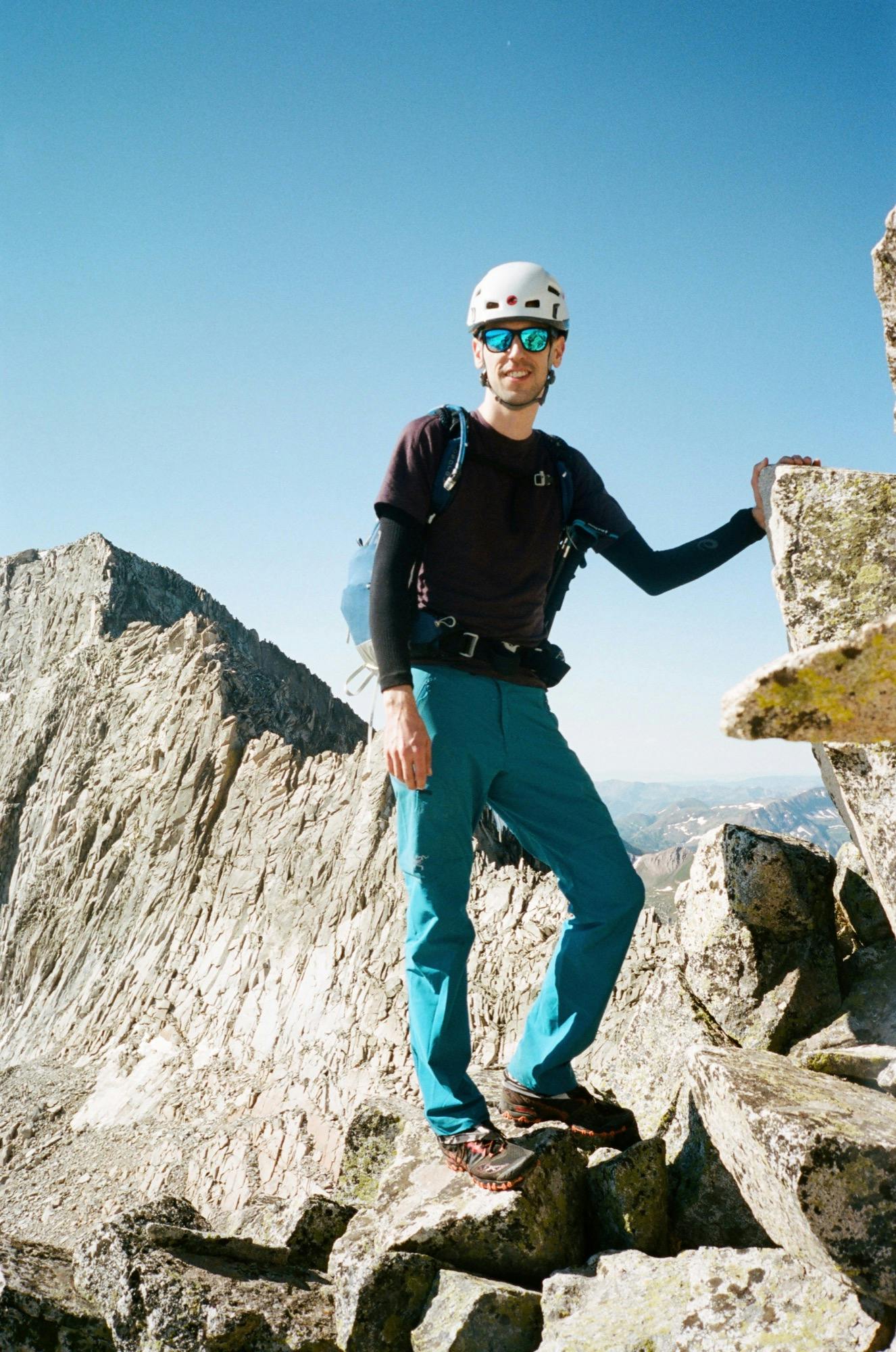
The last bit leading up to the summit you climb up onto the ridge again for maybe 10 feet. I was in the middle following Doug who warned me saying, “I hope nobody minds a bit of exposure”. I tried not to look down, but could see that on either side there was quite the drop off. A few steps later and I was on the summit, happily sitting on a large boulder, enjoying the views.
Though we had seen nobody else on our hike up there, we shared the summit with about 6 others. We took pictures and enjoyed the amazing views of absolute wilderness as far as we could see (Snowmass is known to be the one fourteener that can't be seen from any road).
The way down was about as slow as the way up, but the most remarkable part was finding this natural little water spout around 13,300 feet, shooting out from under some snow off a boulder, and perfect for drinking some ice cold water out of, directly from the source. We all filled up there, made a mountain soda with some Nuun, and basked in our accomplishment. Once down to the bottom, we all jumped in the frigid lake, packed up, and headed out from camp for yet another tough climb.
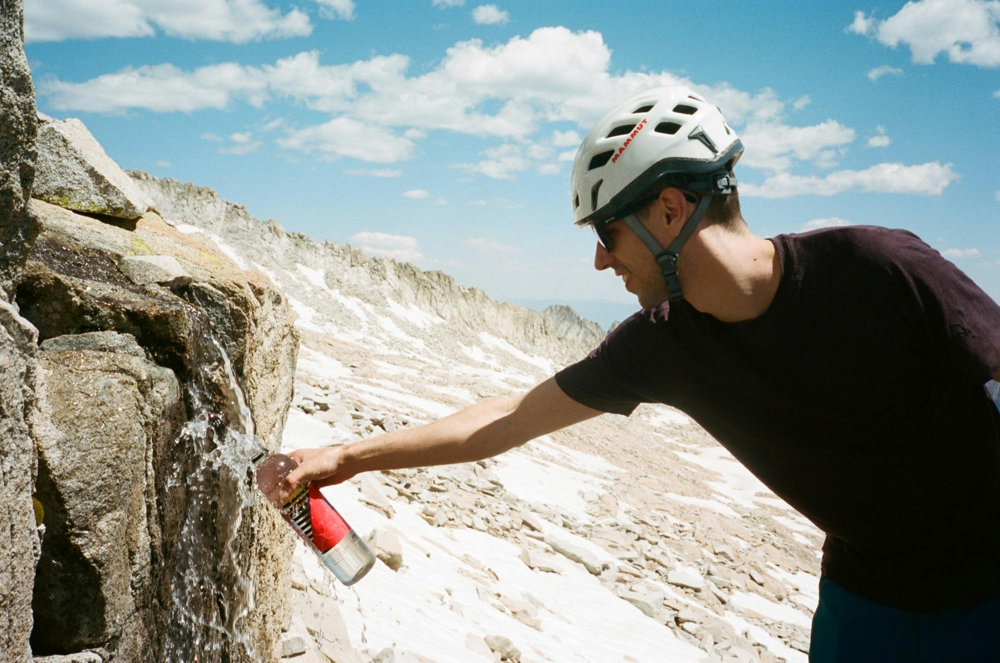
Ice cold melted snow
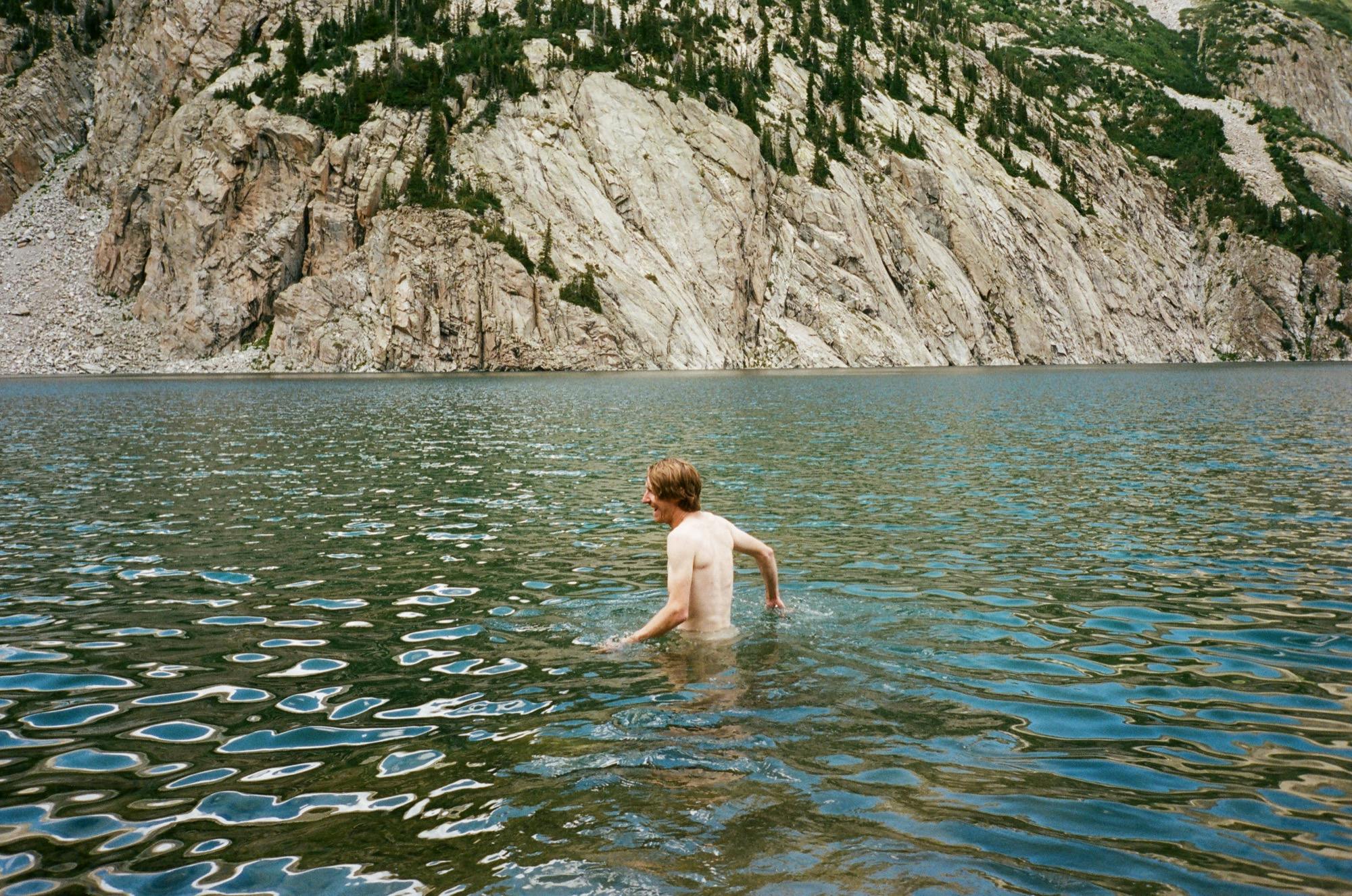
Taking a dip post-Snowmass
Helpful Resources
Date
July 4, 2018
Where
Snomass Lake to Snowmass Summit (14,092')
Distance
6.6 miles, 3,277' elevation gain
Time
Start 6:00am, 7:16hrs total
Wildlife Sightings
Marmots
Highs
Hiking the ridge, drinking directly from the Snowmass melt
Lows
Being scratched and groped by the willows
Day 2, Part 2
Snowmass Lake to Geneva Lake
We donned our heavy packs once again and set the same direction around the lake as we had gone to summit Snowmass, but higher up and slightly less willowy. The trail started climbing pretty quickly, and didn't stop until we got to Trail Rider Pass at 12,400 feet.
Cheesing on Trial Rider Pass
The trail up to the pass is a pretty mild grade, but the ups are incessant for two miles of dirt trail switchbacks. Since this is the part of our journey that overlaps with the popular “Four Pass Loop”, we saw many people. This was the most crowded part of our whole trip (but still nothing compared to most of the popular hikes in the Whites this time of year). Some women we passed told us they had seen mountain goats right on the pass, which gave me the extra motivation to keep climbing.
This was our first of many passes over the next few days and it was incredible to make it to the top and have a totally new set of views over the other side. We had a snack and took in the view, and cried a little about the lack of goats, then headed down the other side on our way to Geneva Lake.
The lush other side of Trail Rider Pass
The other side was a very lush grassy valley with a little stream winding through the willow bushes. The trail descended a ways and then rose slightly. We saw some folks camping among a little stand of trees in this mosquito-less Eden, and we scoffed at their disrespect for finding sanctioned campsites. We made it down to Geneva Lake before long and then yearned for our green pasture as the mosquitos showed up again in full force as soon as we dropped our packs.
Geneva Lake was certainly quieter than Snowmass Lake. We camped on the Western side of the lake. A significant stream crosses right over the trail, so we hiked the last quarter mile uphill to our site with soggy shoes. A deer visited us at our campsite for a few minutes while we were setting up. Though our bodies deserved a nice rest, we ate our dinner snacks standing up wiggling around in our rain gear to ward off the bugs. After a quick water filtering party, we got in our tents and fell asleep before the sun set.
Final descent down to Geneva Lake and where the mosquitos caught up to us
Date
Jully 4, 2018
Where
Snowmass Lake to Geneva Lake
Distance
5.25 miles, 1,696' elevation gain
Time
Start 3pm, 3hrs total
Wildlife Sightings
Marmots, deer
Highs
Getting to the top of Trail Rider Pass
Lows
All the up, after an already up day. Mosquitos at camp again.
Day 3
Thunderstorm on the Enchanted Road to Capital
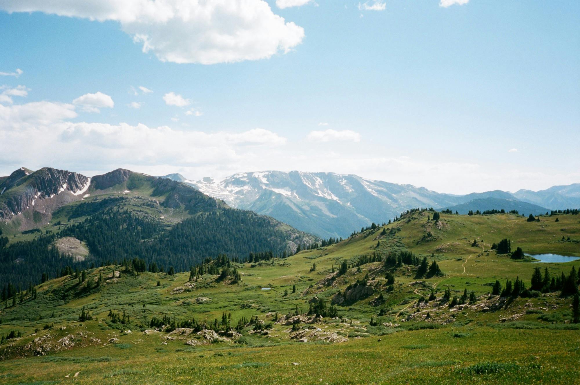
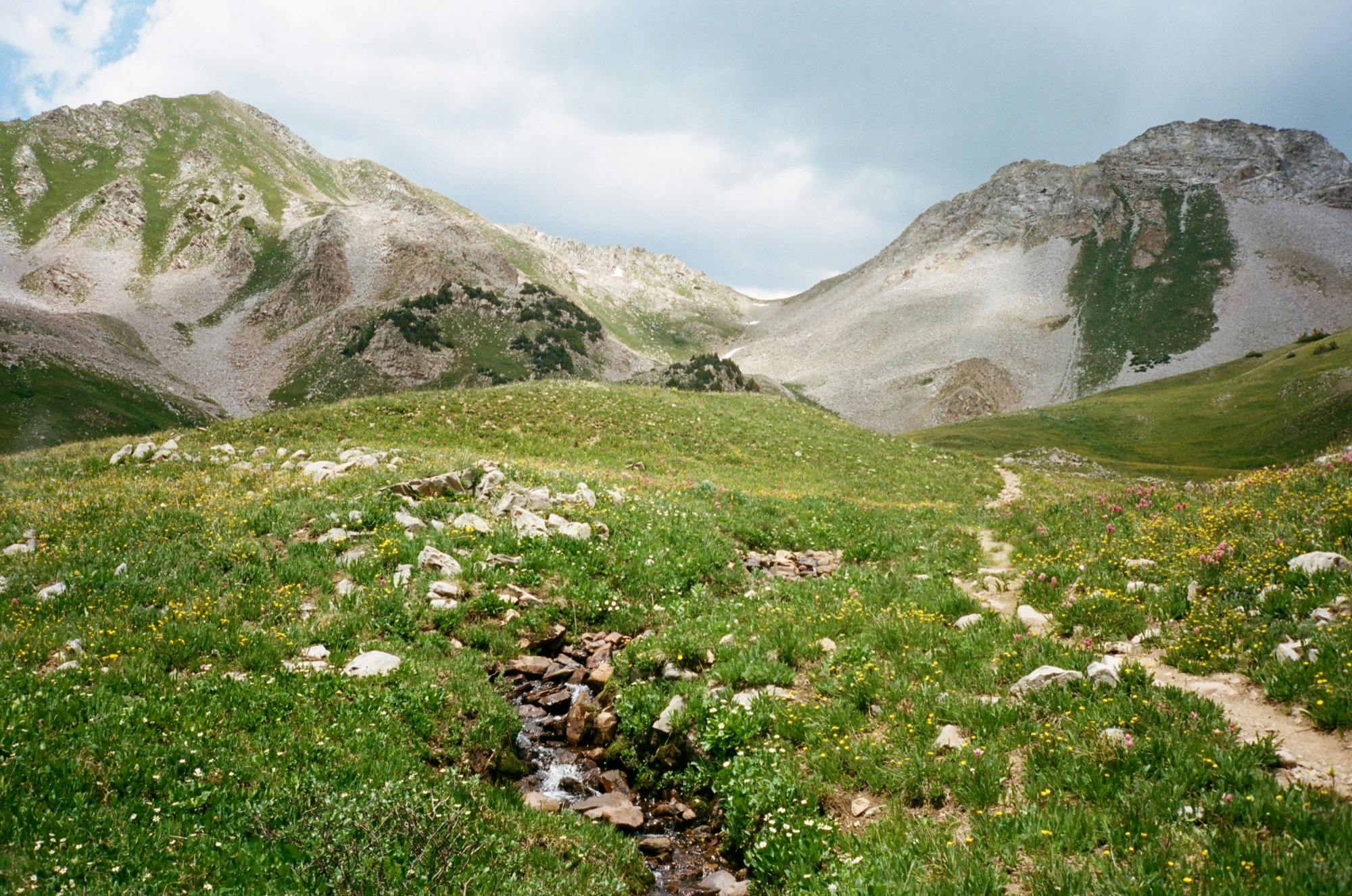
We took our time replenishing calories and packing up camp, despite the ever-present mosquitos. It was yet another sunny morning in the White River Wilderness, but things would change as the day progressed. For now it was already hot, which was ok trekking downhill, but would make a dusty turn for the worst on the up. We continued along the trail around Geneva Lake, then headed down on switchbacks through some lush green flowery sections, with views out toward unnamed snow-covered peaks. At the bottom, we came out of the wilderness to the start of the Jeep road back uphill.
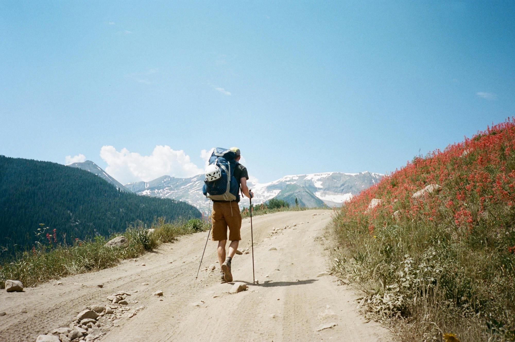
Jeep Road and the sea of red
This would have been a candidate for worst part of the trail due to sun exposure and kicked up dust, but the sea of red wildflowers and amazing scenery made up for the slog ever upward on wide and long switchbacks. Each time a Jeep full of holidaymakers passed us, I stopped to cover my nose and mouth with my t-shirt, and gave a bitter sunglass-hidden stink eye to those chosing the motorized route up. Eventually, we came to the end of the dusty but yet still beautiful trek, filled up our waters from a stream at the top, and headed back into wilderness and away from motorized vehicles into the most beautiful section of the Circuit.
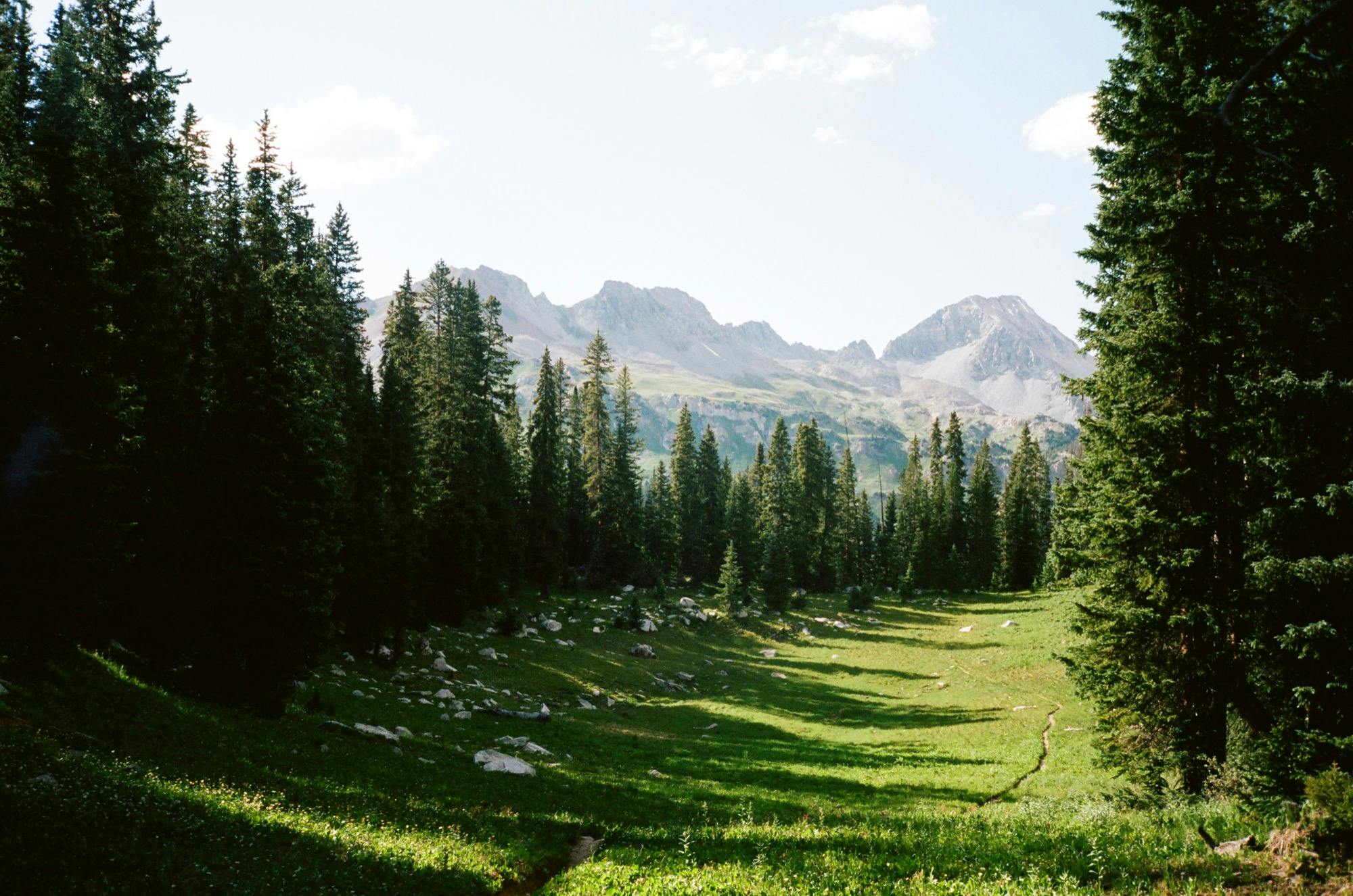
The trail starts up through a lush green meadow sprinkled with wildflowers. At the beginning, there's a stand of tall pine trees with a white stone memorial placed below. We took our time making our way up, taking in the incredible views: the perfect streams and flowers and grassy hills. At the end of the meadow, the trail turns up the steep mountains in rocky switchbacks. Here, we saw our first hiker of the day, almost 5 hours into our adventure.
Walking through the meadow
Stream running through the meadow, mountain pass in the background
The view from the pass was spectacular. The valley on the other side was gorgeous with little pockets of trees and rocks sprinkled throughout a very verdant world and surrounded by epic rocky peaks, Capitol being one of them. The sky had darkened and so was amplifying the epicness. We made our way down into the valley, passing several people heading up to the pass. The trail was harder to follow as the super green plants of these parts seemed to have a stronger fight against bipedal travel than others we had seen. We followed one cairn to another and managed to stick to the general direction.
Pass to the enchanted meadow
Walking into the storm
Eventually our perfect weather streak ran out and we got belted with hail. We made way for the closest group of trees to take shelter and wait the thunder out. We three crouched awkwardly and quitely among the pokey branches, pulling out more and more layers as we accepted this being of the longer-than-five-minutes variety of storm. Once it had been 10 minutes since the last roar of thunder, we got ourselves out of our tree huddle and bushwacked back toward the trail, but the rain stayed pouring, and it was already after 5pm. We found a really perfect spot and decided to set up camp, having already exceeded our goal of 10 miles that day. We quickly threw up the tents in the rain and hunkered down.
Temporary camp to wait out the weather
A half hour later and of course the sun was shining. We decided to pack up camp and continue on toward Avalanche Lake, and I'm so glad we did. The storm left the sky an intense canvas of dark blue, god rays, and golden streaks of sun. The air was so cool and I felt refreshed and somehow cleaner just being rain soaked from before.
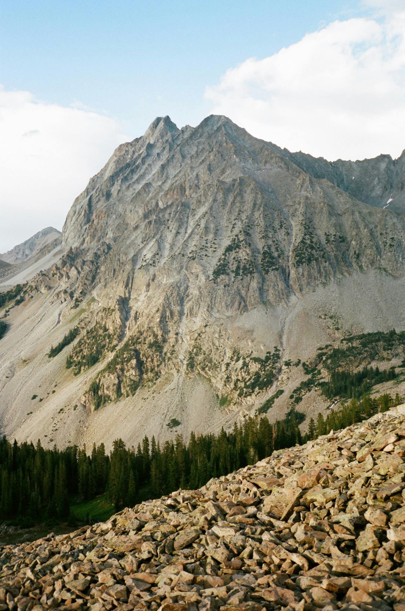
We had an easy rolling climb on a narrow path along the side of the mountain, sometimes rocky and boulder-strewn, then the next second cutting through grass and spectacular wildflowers. We stopped often for photos, and to utter amazement at what a beautiful spot we were hiking through. When we made it to the top of the pass, we were treated with an awesome view of Capital Peak. Having been the final adventure for many-a-hiker last summer taking 5 lives in just 6 weeks, I had developed a respect for this mountain, and the way it looked in the post-storm light only reinforced that. Now this was a Mountain.
Capitol Peak
View back down into the valley
Having learned that lakes mean mosquitos, we decided to save our final descent to Avalanche Lake for the morning and throw up camp on the first level spot surrounded by boulders off the trail where we could watch the sunset on Capital. We were treated to a ruby-red mountain show as alpinglow painted the grey rocks all around us.
Just as we were finishing up dinner the rain chased us into our tents for the night. After 14 miles and two passes, I was happily lulled to sleep by the sound of rain on the tent. The rain lasted for a very long time, but when I awoke in the middle of the night to pee, I got a specacular big sky full of stars.
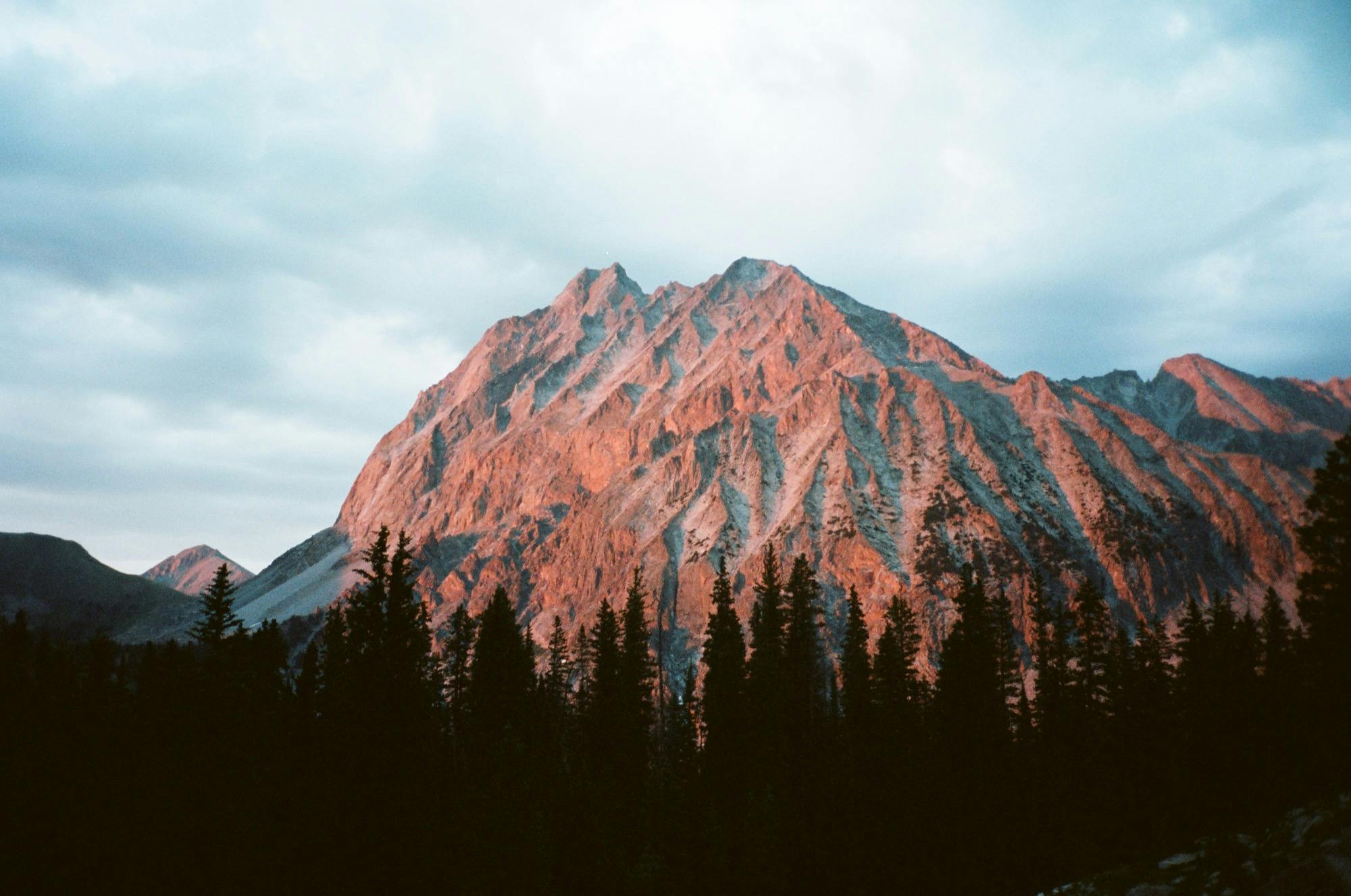
Alpenglow
Date
July 5, 2018
Where
Geneva Lake to Avalanche Lake
Distance
14.5 miles, 3,200' elevation gain
Time
Start 9:30am, 8.5hrs total
Wildlife Sightings
Just Marmots
Highs
Epic views all day, beautiful inclement weather sky, alpenglow on Capitol Peak
Lows
Trapped by a hail thunderstorm in a scratchy stand of trees
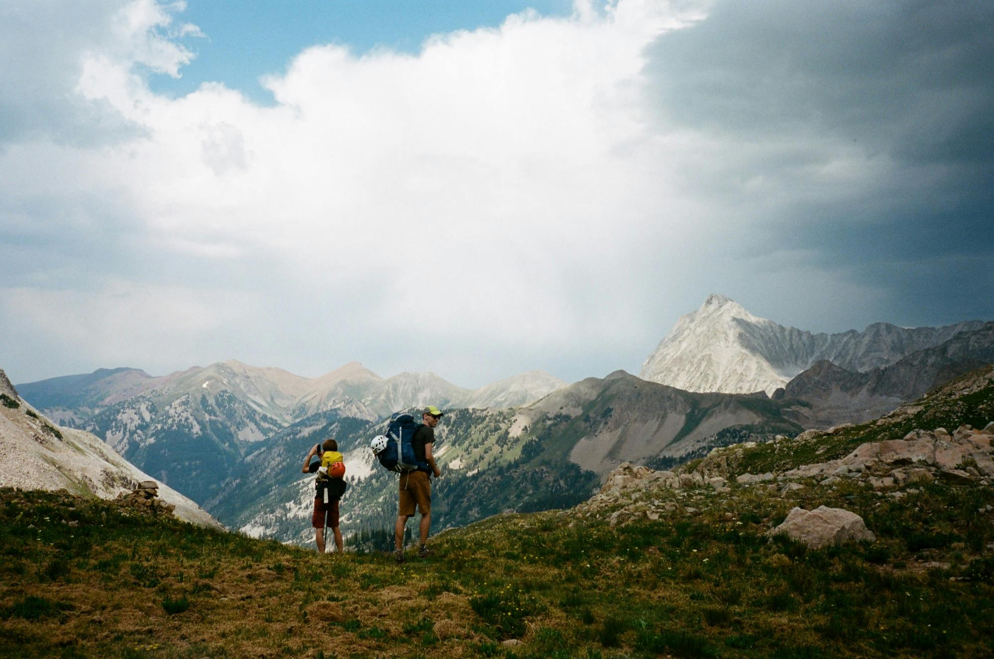
Day 4
Do y'all smoke weed?
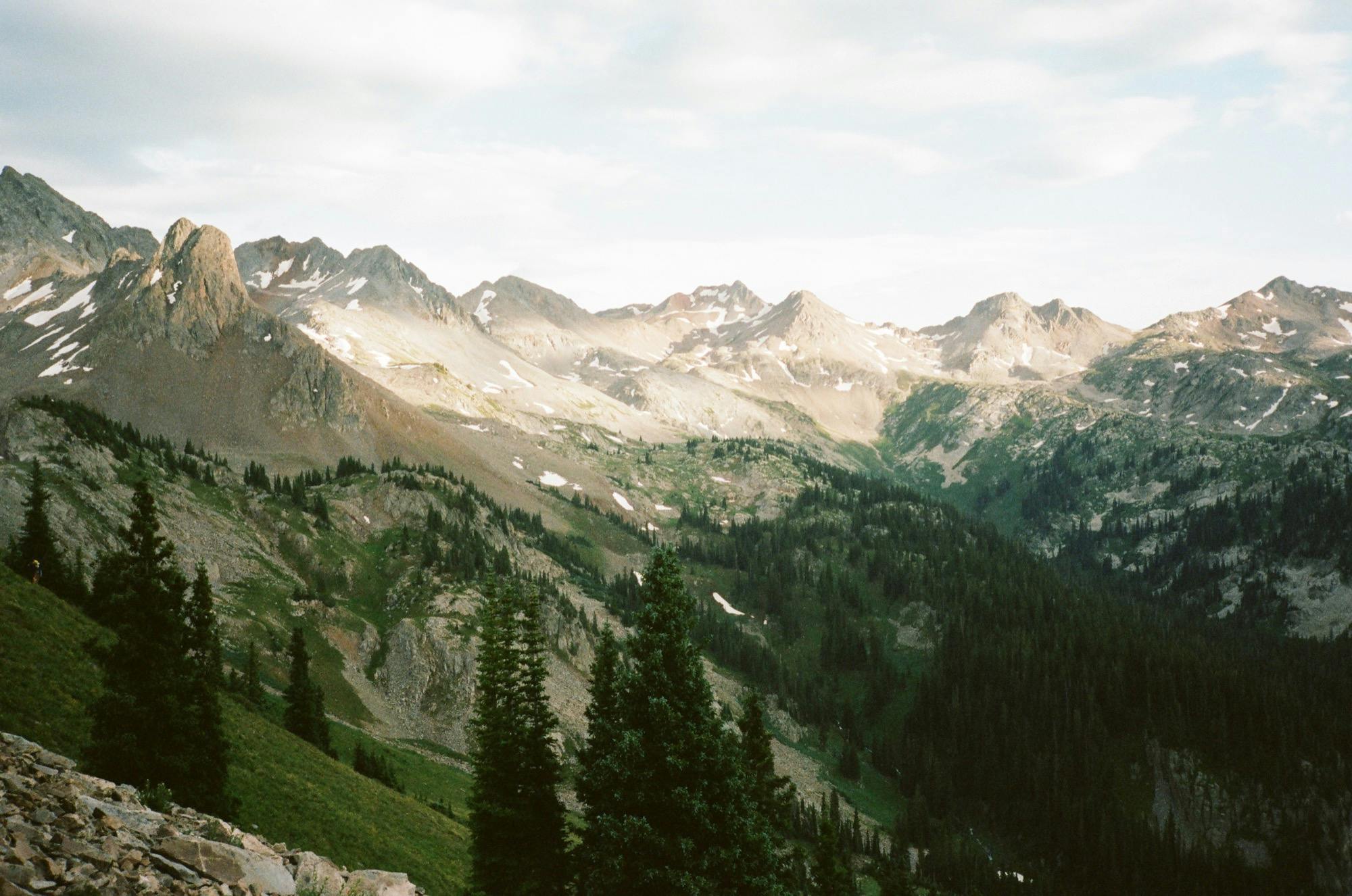
Snowmass and Capitol from Haystack
Our last full day of the trip was bittersweet. We were hoping to tackle the last two passes: over to Capitol Lake and over Haystack Mountain. We rationed our snacks for the day and packed up camp in the shadow of Capitol Peak. It was warm and sunny already, and we knew we had another hot one coming. We got back on trail and stopped at the first stream we saw, passing idyllically through the grass surrounded by evergreens.
As soon as we threw on our heavy packs and started down the trail, we were met by a frazzled looking man heading up trail.
Rob: "Have you guys seen an older woman alone?"
Us: "Um, no"
Rob: "Fuuuuuuuuuuuuuuuuuuuck"
Us: "Well, we really just got on trail, and we were camping off it"
Rob: "Nah, you woulda seen her. She woulda said something to you... Well, I guess I'll head back down with you guys"
Mountain Man Rob
Thus commenced our brief but memorable hike down to the junction to Avalanche Lake with Mountain Man Rob, a local guy in probably his late 50s with a thick Colorado outdoor bro accent who walked right out his front door and out into this wilderness. I guess he and his girlfriend were hiking together the night before and he stopped to take a photo of a Ptarmigan and she went on ahead and they got separated. She had the stove and he, the tent. Given that it was pouring rain for hours, that was pretty concerning to all of us, but he seemed confident that she knew her way around well enough that she was probably ok.
He furiously wanted to know how we heard about this hike. "This place is the last bastion of Colorado wilderness, and nobody ever came here until someone wrote something about it online. Was it Outdoor Magazine? Those guys deserved to be shot. With a rubber bullet. I saw ELEVEN people out here yesterday!" He seemed to like us, depsite the fact that we were ruining his wilderness.
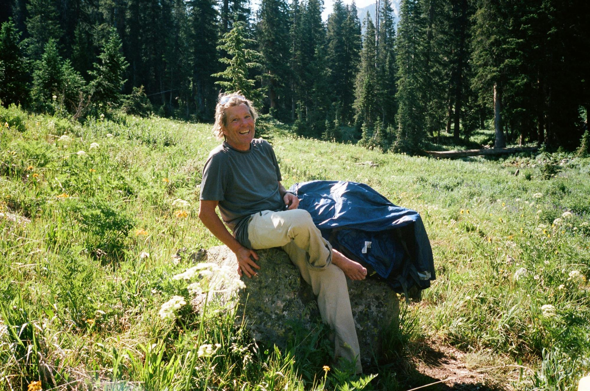
Some of the more memorable Rob'isms: About ultrarunners out here with next to nothing for gear, in comparison to his full rain suit straight out of the early 2000's to combat the morning dew: "I've been spanked out here enough times to know, amigo." About how wearing heavy packs (like us) affects one's ability to maneuver: "When you step on a rock in the water and your pack shifts just a skosh..." His reaction to me saying it was my first time in Colorado: "You're a spoiled a brat! You're first trip and you end up here!?" We would lose him behind us as he stopped to get down and drink directly from a stream. He was the real deal.
We learned he was a photographer, but he didn't want to be famous and so he kept all his work under a different name. He was also a wild forager. When we made it to the junction with Avalanche Lake, he excitedly asked us: "You guys smoke weed?!" We were sorry to disappoint, but he understood as we had a full day of climbing ahead of us. We dropped our packs and went to check out the lake. When we came back, he had shed his rain suit and was ringing out his socks. He figured he'd wait for a while to see if his girlfriend came around, then head back home. I wish we could have met her. He bid us farewell with "Blessings" and a bow.
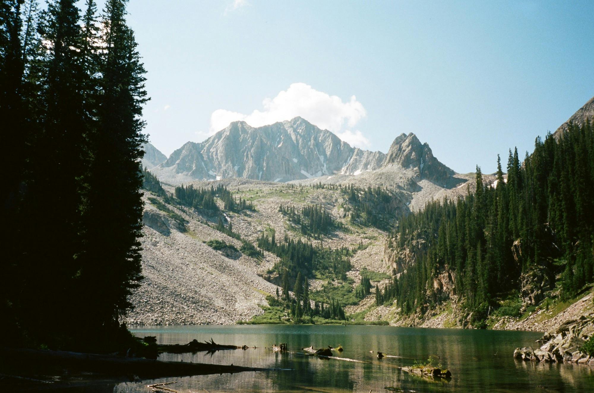
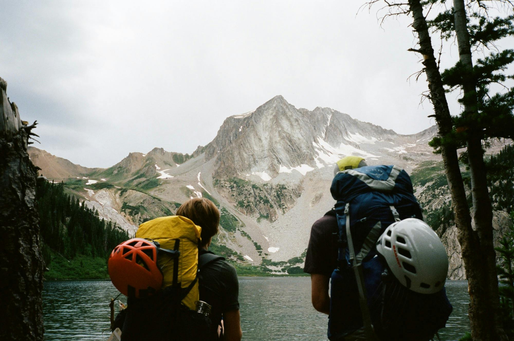
Avalanche Lake
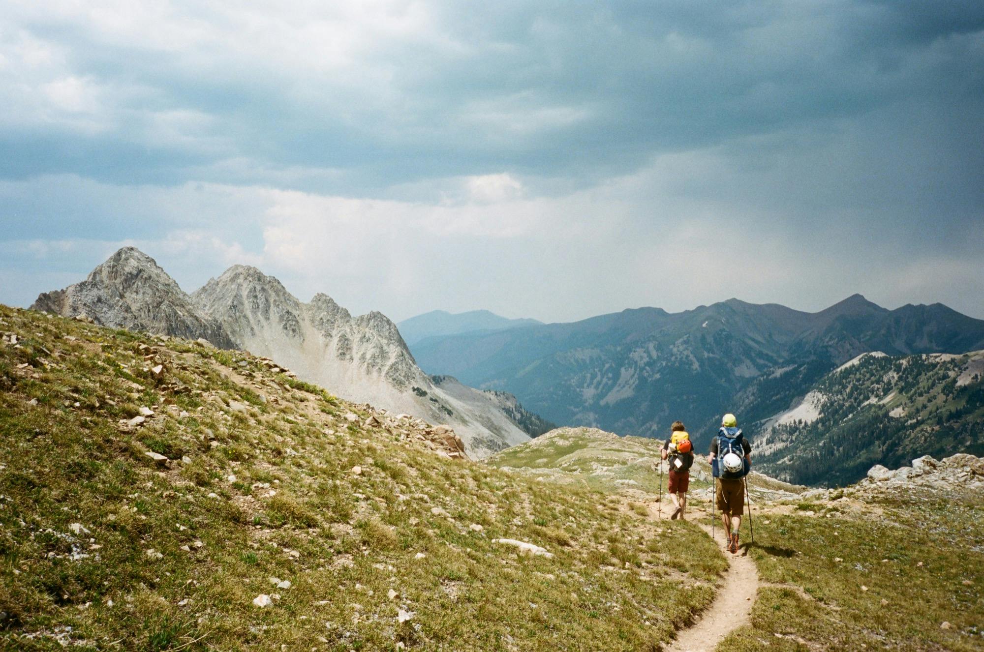
From here, we realized most of the GPS tracks were wrong, and we spent a good deal of time finding the trail up to Capitol Lake as Rob warned we would. Once we found it, it was a steady hot slog up switchbacks through the forest – not nearly as nice of scenery as we had for our climbs yesterday. Finally we made it out of the trees for the last bit up to the pass to Capitol Lake. Again, a little disappointing after our epic day before. We truly were spoiled.
We continued down to grey and snow-fed Capitol Lake, eyeing climbers heading up to the summit and thinking hard "I really hope they're safe" as Capitol has a bad reputation after all the deaths due mostly to randomly loose rock last summer. We skirted around the lake and back into beautiful wildflower-blanketed meadow, sloping softly downhill. Then came a forested section of switchbacks were Doug spotted a big black bear a safe distance below! We stopped and watched as he or she went about their bear business. They saw us and didn't seem too disturbed. Mere minutes later, I spotted another one higher up in the meadow ahead, ducking behind some shrubbery. Giddy with our bear spotting sucess, we passed a woman who wasn't as cheerful about the news as us, and she hiked back a ways to meet up with her family, maybe to make sure there were slower folks in her party?
Pass to Capitol Lake
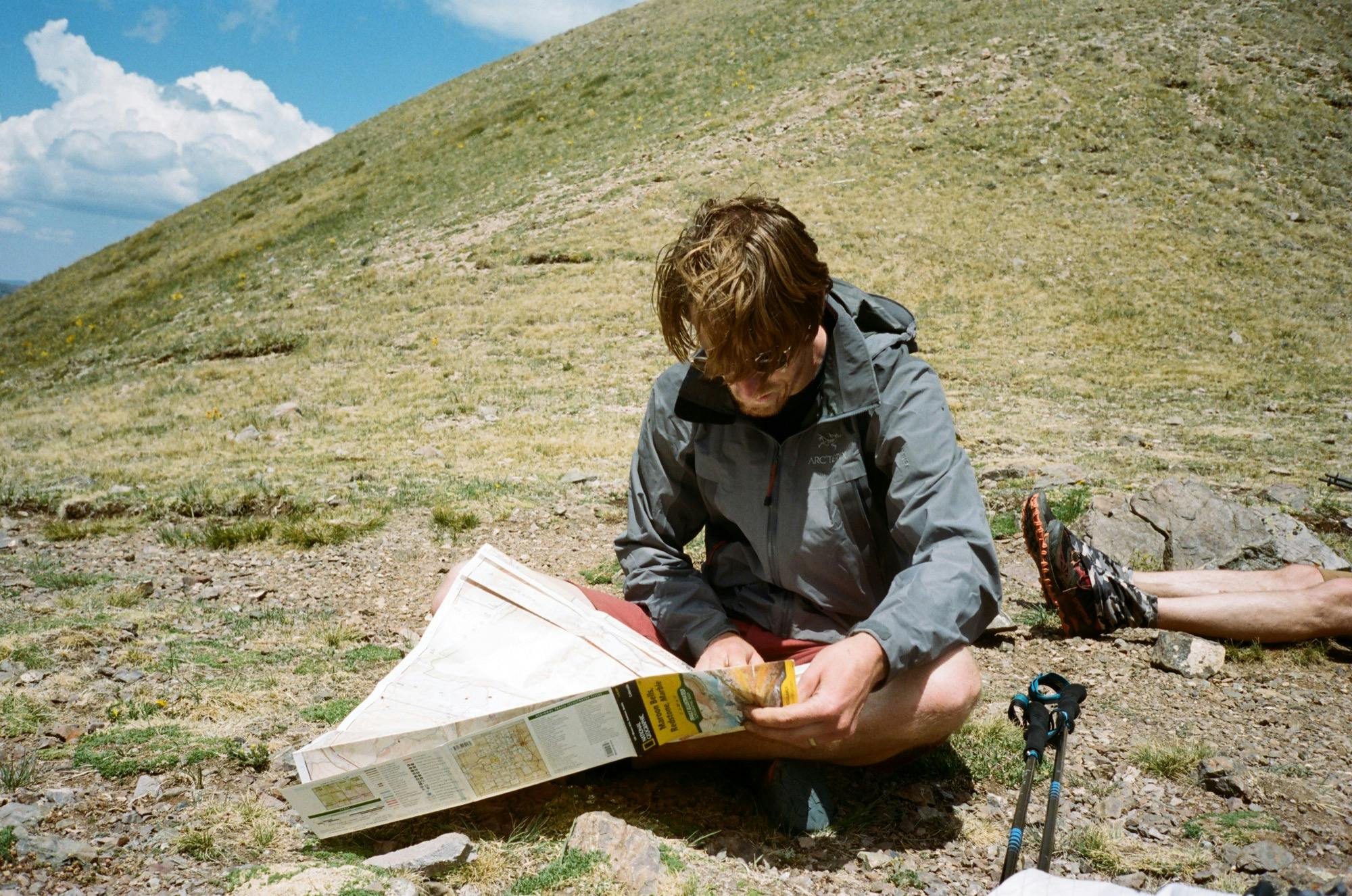
Exhaustedly checking the map
The next part was awful. It was the heat of the day, and we were hiking on this dusty windless trail through cattle fields up and up through the merciless sun. We didn't speak, we just slogged onward, hoping our water supplies would hold out. The trail wasn't on any map, and sort of made a short cut up toward Haystack mountain. When we made it to a shady spot under some trees, we stopped and felt the air wasn't actually very hot at all, it was just the lack of wind and shade along with lugging heavy packs uphill. We started to question why we were even on this trip (maybe not, but you get the picture).
I was relieved when we ran into some older men heading down the trail, assuring us that this is the way up to Haystack. They were headed out of the wilderness that day and couldn't contain their excitement for town food. "Here's what I'm' going to have: a caprese salad, and then a pint of Ben and Jerry's..." Good for you, guys, we still have another day to go.
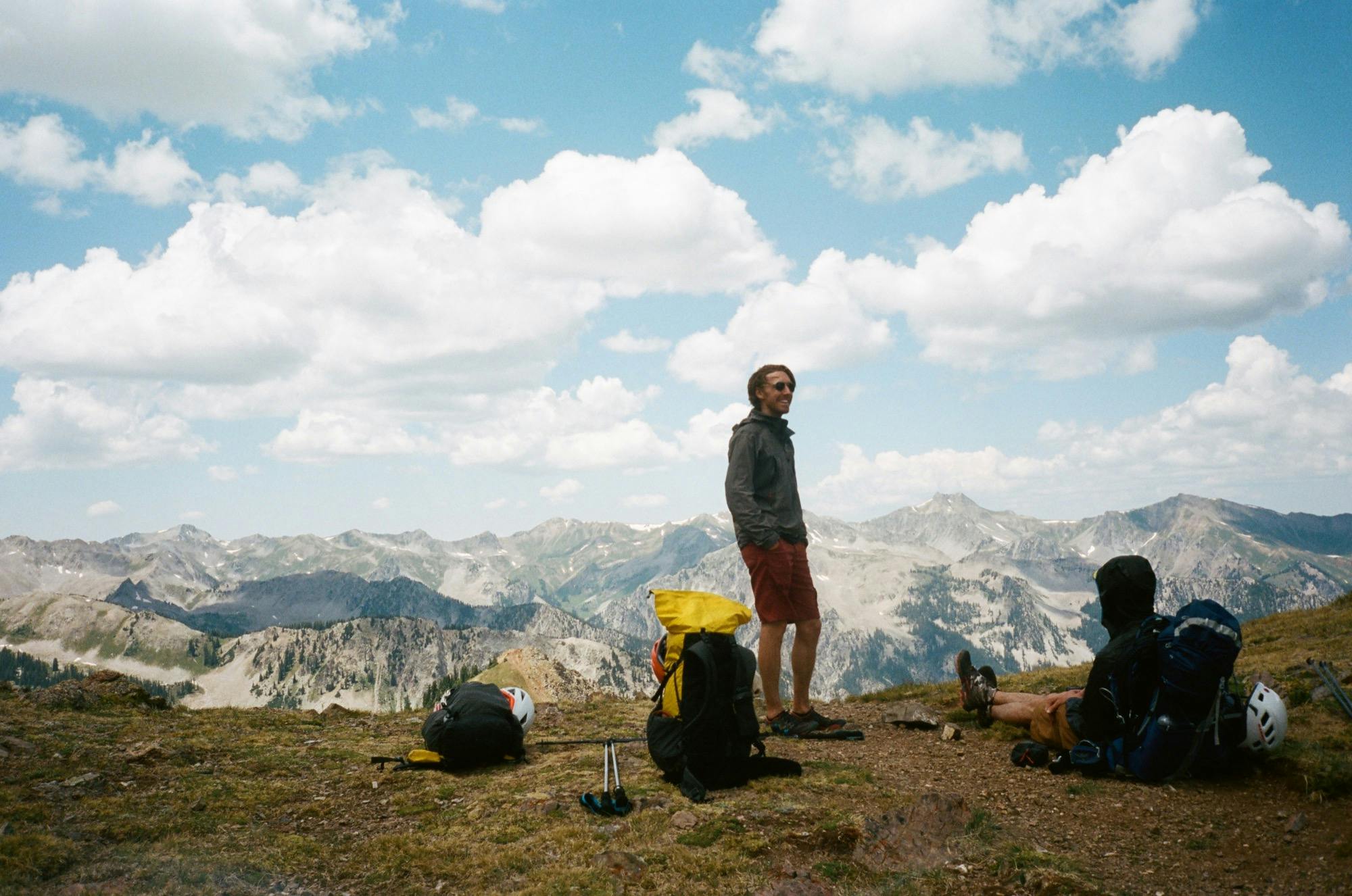
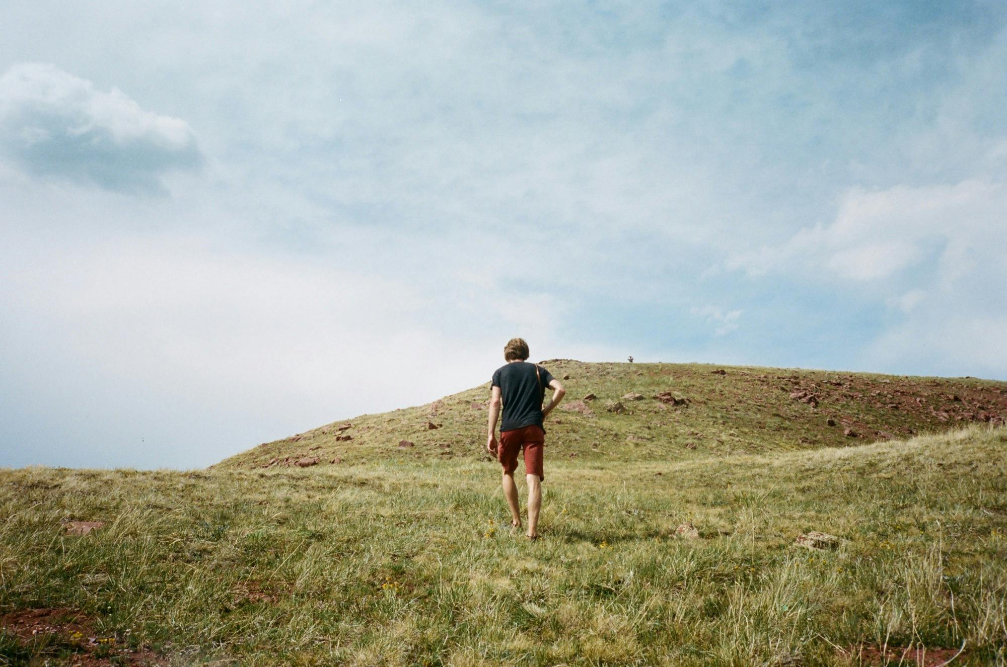
The final push up to Haystack was steep but much more pleasant than the preceding bit, and when we made it to the pass, we were so reinvigorated, we decided to walk clear up to the top of the mountain for our last high lookout of the trip. The grassy hill was bigger than it looked from below, as these things go, but we'd committed, and it was worth the 400 foot climb. We saw Snowmass, Capitol, and Daly standing tall in front of us. We signed the summit log, a rolled up notebook in a tube, then raced down to the bottom like kids running down a big hill. I won, but I don't think anyone knew it was a race besides.
A pack-less scurry up deceptively tall Haystack
Fresh out of water, we were happy to find a beautiful stream right down from the pass. We filled up and started looking for where we'd camp the night, as it was all downhill from here to the trailhead (I thought, sadly). We quitely hiked our way down switchbacks until we found the perfect spot – a meadow with streams winding every which way through it and a perfectly framed view of Snowmass. We dropped packs, set up the tents, and then discovered my favorite part of the camp – a red toilet in the woods. It felt like a throne after days of digging catholes. What luxury.
We took turns dipping in the excrutiatingly cold stream water then ate whatever we wanted from our snack pile, and watched the sun set on Snowmass.
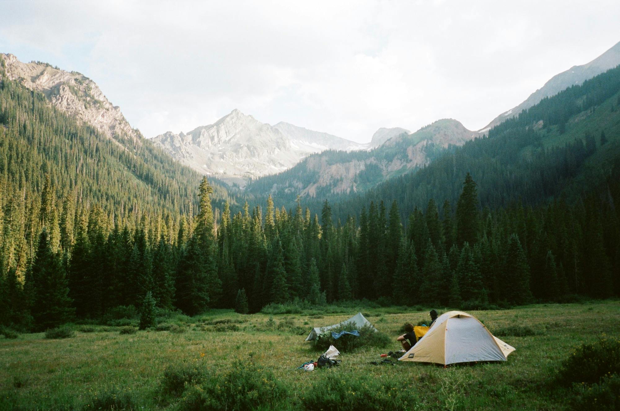
A camp site for our last night.
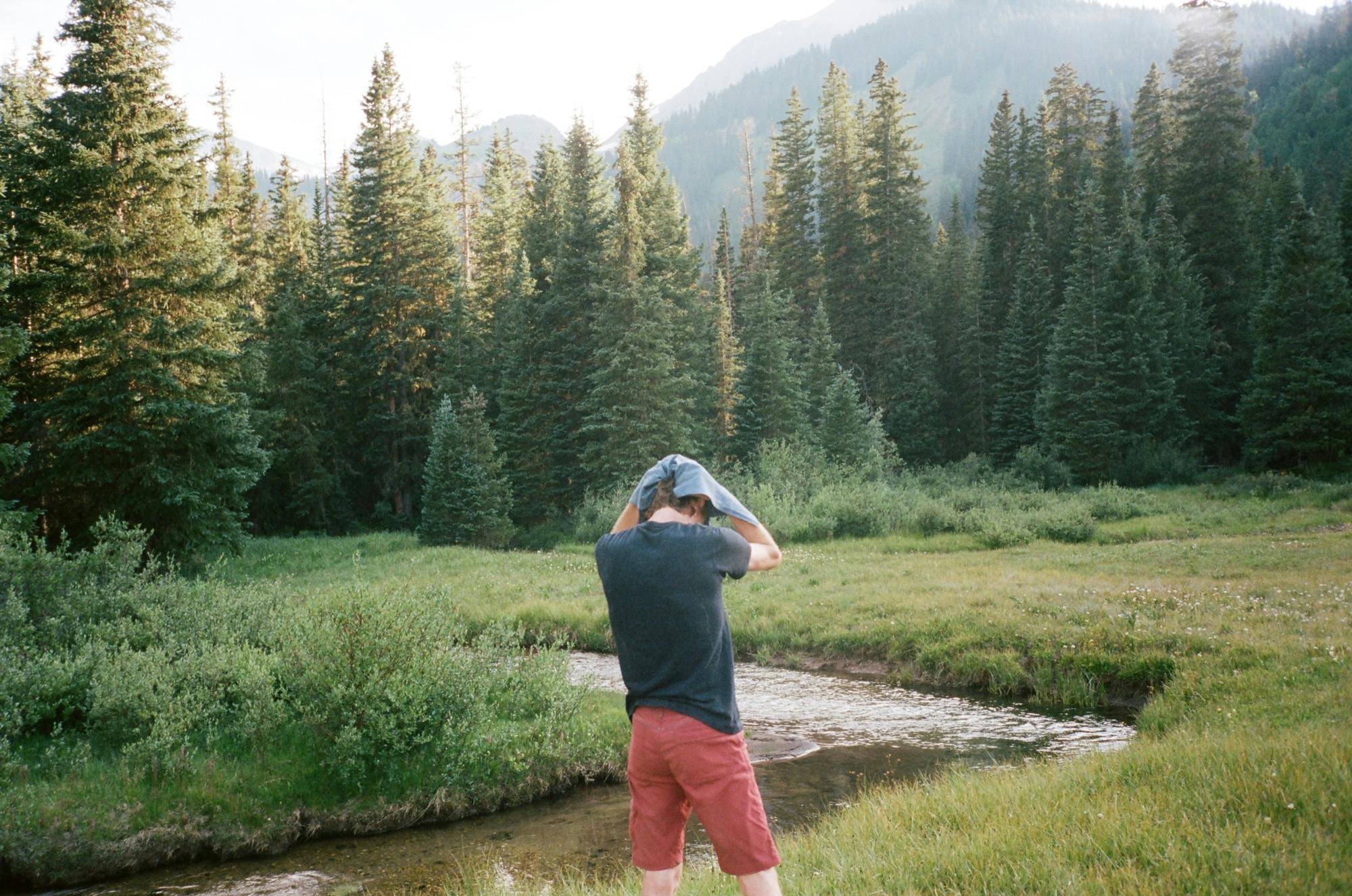
Toweling off after a wash in the icy cold river.
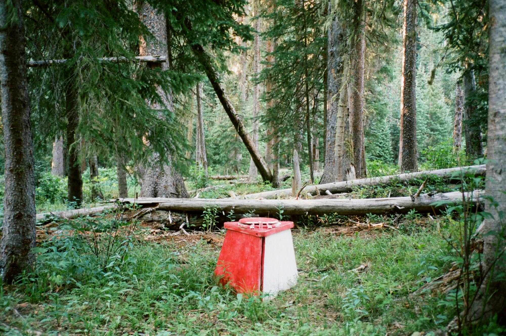
Magical red woods loo.
Date
July 6, 2018
Where
Avalanche Lake to below Haystack Mountain
Distance
16 miles 3,907' elevation gain
Time
Start 8:54am, 8.5hrs total
Wildlife Sightings
Bears, Marmots
Highs
Meeting Mountainman Rob, bear spotting, running up and down to the summit of Haystack Mountain
Lows
Trudging through the dry heat up to Haystack Mountain.
Day 5
Following the herd back to civilization
Cows on the trail out.
The last day was a short one. As the end was inevitable, I let myself get excited by town food and modern plumbing and pressing a pedal to move forward. But to be honest, I could have stayed another week more out there.
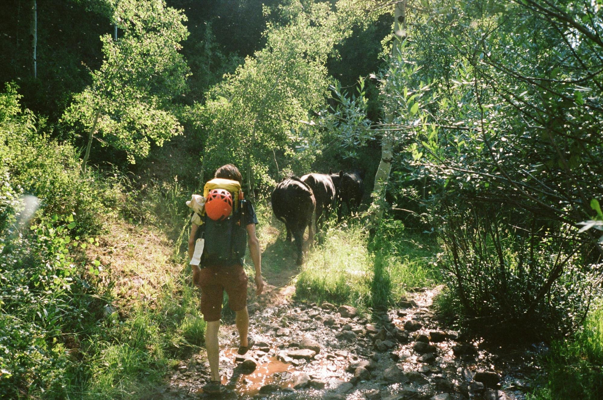
We packed up camp and used the red throne one last time before setting about our short trip back to the trailhead. The trail wound through a forest of very large aspen trees, switchbacking slowly down. At the perceived bottom, I was in the lead and looking down at the trail, I glanced up and shreiked. Some very large black animals were no more than ten feet in front of me, and it took my brain a second to discern that they were not a giant gang of bears, but some very nervous cows. Cody and Doug behind me got a fright due to my scream, and then we all broke out laughing at the absurdity. Welcome back to civilization.
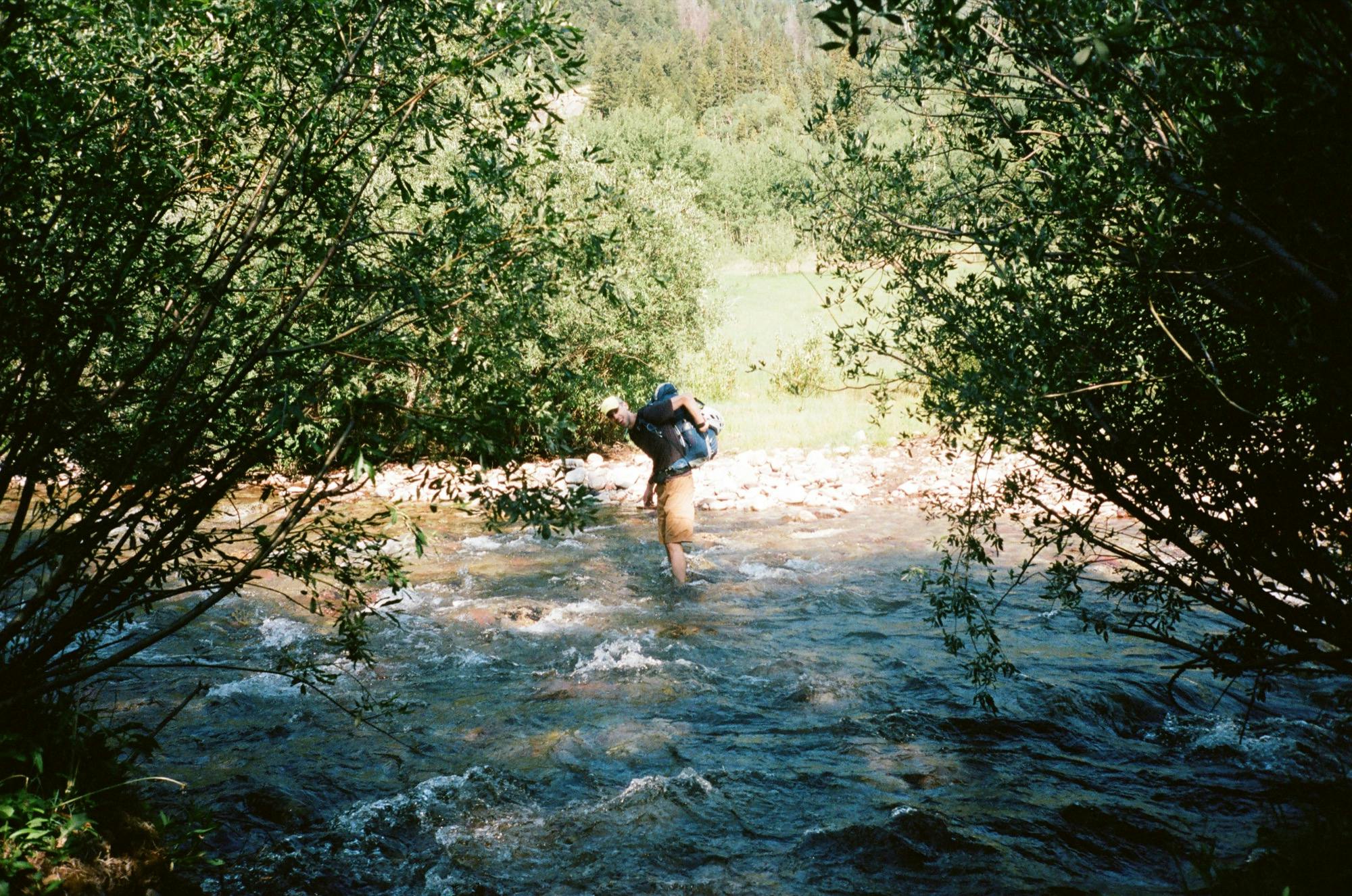
Doug crossing the stream.
Cody took up the front position and sternly told the large and lazy cows to move along. They turned down the trail in front of us, and we thought we might follow them all the way back. Eventually they turned into the forest to meet their compatriots eating the low greenery in the forest. The trail went through some very wet forest and field and finally we had to bite the bullet and wade through a nice cool stream up to our shins to get back to the trail out.
The last dusty section we passed many day hikers and horse riders on their way out. It was Saturday, afterall. A large group huddled around the trailhead, all ready to take our parking spot. And just like that, with a last selfie with our packs on, we drove off and capped off our adventure.
Date
July 7, 2018
Where
The meadow back to the trailhead
Distance
3.8 miles, 167' elevation gain
Time
Start 8:35am, 1.5hrs total
Wildlife Sightings
Herd of cows
Highs
Being scared silly by some cows
Lows
Ending this trip


