
With a forecast of light rain in the AM, then heavy rain in the PM, and being solidly into shoulder season, we set out on our hike today with very low expectations. We were happily surprised. Sure, we had our fair share of on-again off-again with our spikes and crampons, and we did pull out our rain jackets once, but overall it was a very pleasant day out in the Presidentials.
We parked at the train depot at Crawford Notch and walked along 302 a short while before starting toward Mount Jackson on the Webster-Jackson trail. This trail is pretty moderate as far as the Whites go. It meanders through the forest for a while with some beautiful water crossings. The first of these is a little tricky with the amount of water this time of year and we choose to be cautious and hike upstream a few feet to cross over a couple of felled trees positioned to be a 2’ wide (ish) bridge. The rest are rock-hoppable.
There’s a sign for a lookout called Bugle Cliff that is worth a small detour to get views back down toward Crawford Notch. Then the trail starts to climb. By this point we committed to our spikes as the trail was fully covered in icy snow. There weren’t many postholes at the point, but it was easier to hike the ups with the added traction.
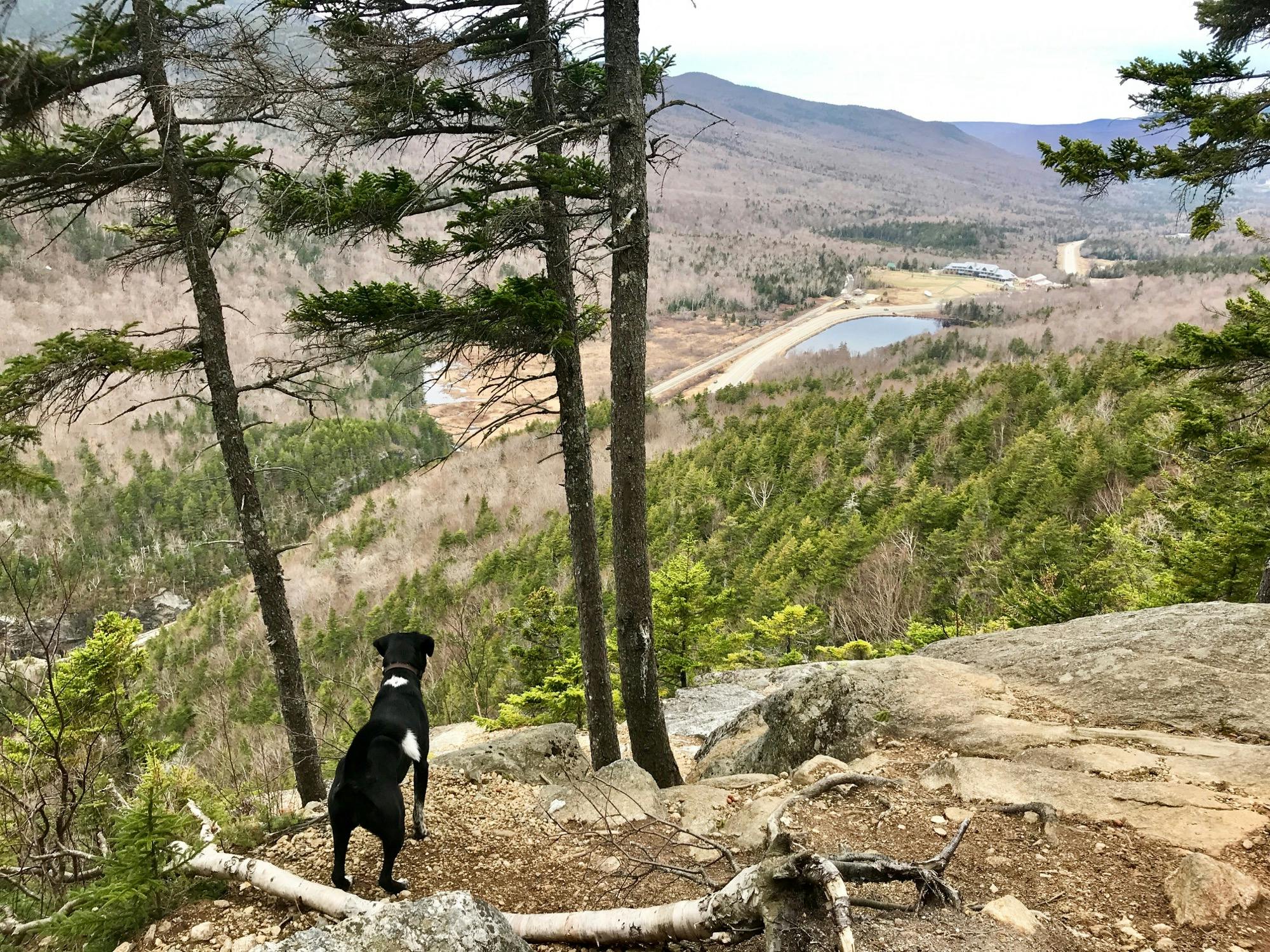
Bugle Cliff
We made it to Jackson 2.9 miles from our parking spot in 2 hours. Though it was overcast, we had clear visibility from all peaks. We could see some rainstorms probably heading our way, but it also didn’t exactly look like the “heavy rain” predicted in the forecast. We felt some sprinkles as we ate our sandwiches atop Jackson, donned our rain coats, and headed down the slippery-when-wet rocks in our bare shoes down into the forest toward Pierce.
Let me repeat, this section is slippery and steep, especially in the shoulder season conditions – rain on the bare rocks and slippery melting snow. We put on our snowshoes when we got into the trees as the trail here was full of postholes. A pretty unstable monorail. The going was slower than usual, but it was a beautiful hike through the forest. We made it to Mizpah Hut (4.8m) in 3:12. Supposedly the hut is open this time of year, but we didn’t go in because we had Rye.
Webster Cliff trail from the hut to Mount Pierce gets a little steep and there are some down trees over the first bit to climb through. The trail evens off before the anti-climatic flat summit on Pierce (5.6m) in 3:50.
Since we had still managed to escape the rain, we decided to push on toward our final peak – Eisenhower. Here, we were rewarded with amazing views, the trail to ourselves, and a spectrum of saturated spring colors as only inclement weather can bring. We followed the exposed trail of large cairns down into the forest before popping out for another section of bare rocks with streams of snowmelt running over it. We managed to do this section carefully bare-booted, though it’s riddled with postholes and we guiltily made a couple more. But the alternative of either wrecking our snowshoes traversing the bare rock or stopping every minute or so was worse.
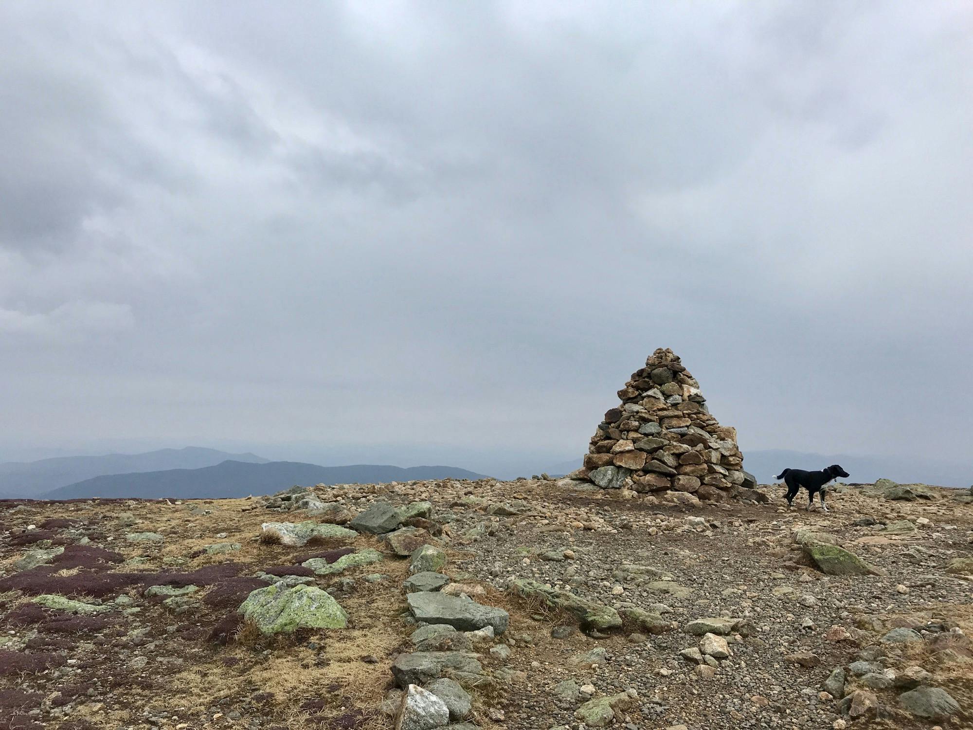
The giant cairn atop Eisenhower
The final climb to Eisenhower is very reminiscent of Scotland for me, but perhaps that was also due to the “fine Scottish weather” we were enjoying. There are switchbacks with wooden stairs and ladders through the vegetated alpine zone back and forth, the views getting better and better back toward Pierce and Jackson. The large cairns continue until the grandaddy of all cairns greets you at the summit with a 360 view of layered blue mountains all around. Looking down Crawford Path toward Franklin, and further on to Washington, made me sad we didn’t go for a Presidential Traverse on such a fine day with zero wind and only little drops of rain occasionally. (We summited in 4:54, 7.4m in)
We turned around after a snack and headed back down the beautiful cairn path to almost Pierce, and continued to follow Crawford Path down. We put our snowshoes on at the trail junction and quickly lost elevation down the post-holed trail. At around 2600’ we switched to spikes for a little while before bare-booting it completely to the bottom. Along the way Gibbs Brook was raging with all the melt. We made it down to the bottom (11.9m) in just over 7 hours then had a short stretch of 302 to walk to our car.
Peaks
Mount Jackson (4,052'), Mount Pierce (4,311′), Mount Eisenhower (4,780′)
Trailhead
Crawford Notch
Trails
Webster-Jackson, Webster Cliff, Crawford Path
Distance
12.08 miles, 4,133' elevation gain
Time
Start: 9:27am, 7:10 Round Trip
Weather
40s, overcast, misting and threatening rain. Zero wind.
Trail Conditions
Wet with small icy patches at the start, then a solid monorail, then a very sloppy melting monorail in the trees at the top. Wet rocks at the summits.
Gear
Snowshoes, spikes, bare boots
Partners in Crime
Cody and Rye
Post-hike beers
Gallery

Snow melting slowly but surely

Bugle Cliff

Summit of Jackson

A Serious Sandwich Man

Following white blazes

Note the ladder in the background

View from Pierce toward Eisenhower

Heading toward Eisenhower

Lovely path of cairns

The giant cairn atop Eisenhower

The Traverse to Washington

Sitting on Eisenhower's summit

Cool sign at the end of Crawford Path


