
We stayed the night before heading to basecamp at the Servimont lodge in Tlachichuca. The lodge is right in the middle of town in a beautiful old soap factory with exposed beams. It’s filled with old machinery, and decorated with old hiking equipment. Aside from guides, transportation, and a cool place to stay, Servimont provided delicious home-cooked meals. As we were enjoying our delicious mango sauce dessert, the owner, Doctor Reyes, came in and explained the mountain situation to us. Like most people attempting to summit the third tallest mountain in North America, our plan was to camp at Piedra Grande hut and hike the Jamapa glacier route. However, due to an unusual very dry season where there was no rain or snow on the mountain, the glacier which is usually “easily” hikeable with just crampons and an ice axe was, in the words of one of our guides, Ulysses, “like an ice rink at an angle”. Ulysses explained our options were to either try the glacier route and probably have to turn around before the steepest part, or change plans and take the Ruta Sur (South Route) which doesn’t have a glacier on it, and is basically just a big scree (read: dusty hell) pile. Ulysses said that only one group had made it to the summit via the glacier that year with them and it took 18 hours (compared with our planned 7 or 8 hours we had expected).
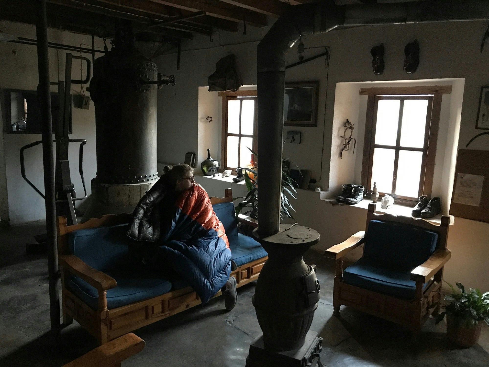
Servimont lodge
Knowing nothing beforehand about the Ruta Sur, we did some quick researching on our phones and in the guide book and decided that, despite hauling our brand new ice axes all around the world for a few weeks, we would forgo the glacier experience for a few reasons:
- Nat had already summited via the glacier last year, and so this would be a new hike for all 4 of us.
- I had already been understandably nervous about the glacier route since one of my coworkers’ wife had slipped and fell over a thousand feet, breaking her leg, and the ice sounded way more treacherous this year.
- We had zero experience ice climbing and we would have to do so to get up the glacier this year.
- We wanted to summit.
After hiking Izta and swearing “never again” to hiking over huge scree piles, we came to terms with our plan, packed up our gear leaving our crampons and ice axes behind, and went to bed. The next morning after a delicious and hearty breakfast, we loaded up the 4x4 and headed on the long route to basecamp. We first had to drive around to the opposite side of the mountain (definitely not as epic looking as it’s glacier-covered North side), then took progressively steeper and bumpier roads until we were practically off-roading (I was thankful for Spencer bringing Dramamine) to our basecamp at 15,000 ft. We set up camp around 1pm and realized we had practically a whole day with nothing much to do, having left our books back at Servimont along with our ice gear. I was exhausted just from blowing up my sleeping pad at that altitude so after a small “reccy” hike (we got winded walking about 1/10 of a mile and back), I took a sunny nap. When I woke up, the boys were literally playing with rocks they were so bored, while our guides and our camp guard (the send you with an extra person to watch your stuff while you hike) hung out with the guides at he neighboring camp. At around 4pm we decided we could eat some dinner – rice and refried beans out of the pot and passed around the circle. With the sun setting, the temperatures dropped significantly and I knew if I didn’t get in my quilt before I lost my body heat, it would be very hard to regain it, so we turned in around 5:30 and slept a full night before our 3am wake up call.
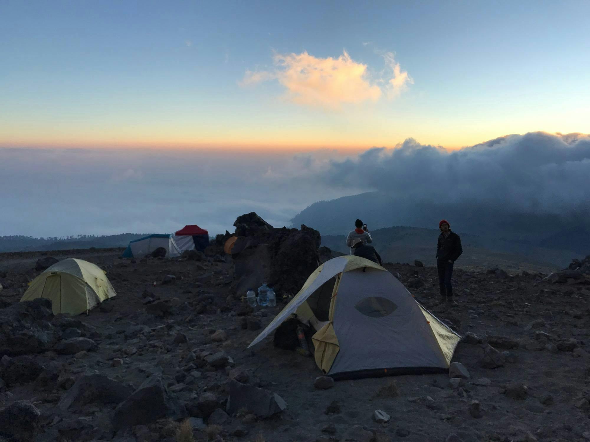
Sunset at basecamp
In the cold dark early morning, we woke up, got ready, drank our communal cup of “jet fuel” and started up the mountain. It somehow felt much easier walking up that bit that had been a surprising challenge the night before, I think because we had slept in the altitude a full night. The moon was very bright so I turned off my headlamp and followed behind Ulysses footsteps. We agreed that we would hike at an easy pace and stop every 50 minutes for a break and water. The first part of the trail used to be the “road” so it was quite easy and before I knew it we reached the red/orange Fausto Gonzales Gomar hut. There we saw another group getting ready to head out. The next part of the trail was hiking up a pretty easy boulder field, though without our guides, I probably wouldn’t have been able to pick out where the trail was. It was at this point the 4 of us agreed that, after our experience trying to pick out the trail and the cold dark night on Izta, the guides were worth it here.
We went up and up, slow enough that I never got tired, but I also didn’t get too cold either. When we were well over 16,500 ft, the sun started to rise. It was a clear day and we could easily see La Malinche, and farther away, Popo and Izta. By the time the sun was all the way up, we hit the really difficult part – a 40 degree slope of loose scree, which was ver easy to slip down or knock a boulder down to whomever was below (with helmets, but still…). We were about halfway up, depending on our poles almost as much as our legs, when Spencer had to stop and pee. It was so difficult to pause on the climb, but the danger of kicking a rock down meant we had to stick together so we waited. Shortly thereafter when the scree because less dangerous, the group split. Nat, Cody and I went with Ulysses, while Spencer took a slower pace with Juan. We sped up and I was so exhausted as we were finally almost to “The Pulpit” and the plane wreck right under it. Nat was up ahead and got excited he could see the summit cross. I need to cool off and catch my breath and have a drink of water, then Cody and I made the final push.
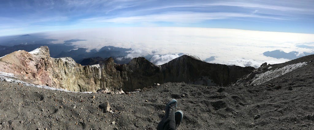
The rim of Pico de Orizaba
I felt a little wave of emotion when I first saw past the summit and into the caldera. We were on top of the world! There were two Spanish women from New York City there with a guide so we chatted with them for a while. Nat and I did a little dancing. The sun felt so warm and comfortable. When Spencer made it, he cried and collapsed – it was a great moment to share with my best pals. We spent maybe 30 minutes up there basking in the sun and glow of making it to the summit before starting down – cautiously down the steep scree (much easier going down, except you had to try hard not to kick boulders to folks down below), then practically running, kicking up so much dust, losing about 100 ft/minute all the way to the bottom. When we got back to camp all of an hour since the summit, we all had headaches from the altitude and I felt quite sick. We slowly packed up camp. The truck came finally and we sleepily made our way back to Servimont, feeling better as we got farther down. We showered, drank beers, ate ferociously, and slept early.
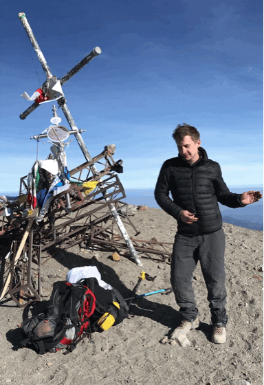
Nat doing his happy dance
Peaks
Pico de Orizaba (18,491')
Where
Central Mexico (Puebla)
Trails
Ruta Sur
Distance
4.86 miles, 3,386' Elevation Gain
Time
Start: 3:45am, 7:45 Round Trip
Weather
Cold in the wee hours of the morning, sunny and warm otherwise.
Trail Conditions
Dusty dry scree
Gear
Poles, Helmet
Partners in Crime
Cody, Spencer & Nat
Gallery

Being the tallest bad hombres in North America

Pico de Orizaba from Tlachichuca

View from the fields outside of Tlachichuca

Tlachichuca

I couldn't get over the beautiful hand painted signs

Servimont lodge

Shadow of the mountain

Gear for Orizaba

Dogs of Servimont

Sunset at basecamp

Spencer in the scree field

Cody during a rest stop

View from the rim

Cody at the summit

Way above the clouds

Summit featuring my backpack

Sunscreening

Back at the lodge post-first-hot-shower-in-weeks (or so it felt like)

Outside Servimont with beers and snacks and a tourist hat.


